Thursday, July 16, 2009

Day 57

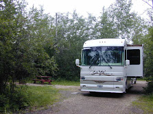
We traveled another 133 miles south today to Fort Hall, Idaho. We are now 150 miles from Hill Air Force Base. We are spending the night at the Buffalo Meadows RV Park. The RV Park is part of the Fort Hall Casino owned by the Shoshone-Bannock Indian Tribes.

Pocatello, ID is just 8 miles south so we have all of the networks high definition over the air broadcasts as well as good internet service.

Tomorrow we will complete our journey to Hill Air Force Base to visit with our son and his family.

Before Fort Hall was established the general location was known as a favorable fur region. Located in a imagesheltered bend of Snake River near the junction of Blackfoot and Portneuf Rivers with the main stream, "The Bottoms" as the area came to be called, had imagefor perhaps hundreds of years been a favorite gathering and camping place for the Shoshone-Bannock Indians.

New England named Nathaniel Jarvis Wyeth on the 18th of July started the construction of a trading post, which he named Fort Hall in honor of the oldest  member of the New England company financing his enterprise. On August 4th he finished the log structure. The next morning, August 5, he raised a homemade United States flag, saluted it with a salvo of guns, and thus, as the result of a broken agreement, Fort Hall came into existence, an event whose historical significance cannot be overrated.


 image

Houses in Fort Hall

Wednesday, July 15, 2009

Day 56

We moved farther south today to Lima, MT, population around 240 according to the 2000image census. Lima is a typical Montana small town, 1 block wide by 9 blocks wide. It appears that Lima's heyday was when the trains needed to stop for coal and water. Although the station and railroad are still here, the trains no longer stop.

We had dinner in the town bar. The building is over a 100 years old and according to the present owner was originally, a bar, hotel, restaurant and a barber shop. It is now just a bar and restaurant with a very limited menu, T-bone, New York, Sirloin and Rib Eye steaks, chicken breast or hamburger served with a salad and bake potato. By the way, you have to cook your own meat and potato on a gas fired grill.

There is no TV reception and the internet speed is very poor via Verizon air card.

The huckleberry pie lasted 2 nights, somehow we managed to eat a half pie each night.

Monday, July 13, 2009

Day 54

Well when you can get no one else to the job, one must do it himself so Pop baked his own Huckleberry pie thisHuckleberry Pie morning.


BBQ In Snow13 The pie went well with the BBQ pork chops that Pop cooked this evening in a Montana snow. Even Mik enjoyed the pie and especially the whipped cream from the magic can. It was Mik’s reward for having to stay in the coach while we toured the Lewis and Clark Caverns in the afternoon.


Wonderground

clip_image001The marvels of Lewis and Clark Caverns State Park. By Scott McMillion

This story is featured in Montana Outdoors
July–August 2004

This is a story shaped by water in all its forms: tiny drops and rushing torrents and rising vapors, rainstorms that slicken hillsides and droughts that crack them open, gullywashers that uproot trees and ice that can crack a stone. It’s about the greatest of floods, and it’s about the warm mist of your breath.

At Lewis and Clark Caverns State Park, whether you’re underground or above it, the world around you is shaped by water.

Water sculpted the famous caves, drop by patient drop, hauling microscopic bits of stone from one place to another. And it was water, appearing as steam from the ground one cold day, that originally brought white men here.

Tom Williams and Bert Pannell first peered into the caverns on a winter day in 1892. They’d been hunting and saw what looked like a column of smoke rising from a hillside. They labored up the mountain to investigate and learned that it wasn’t smoke at all: It was steam, the steady exhalation of living, breathing caves. The warm air was pushed from the mountain’s lungs only to become ice in the cold air, transformed into crystals so tiny they floated skyward and evaporated in the sun.

American Indians had seen this “smoke,” this breath from a mountain, or at least that’s the way the story goes in the farms and towns around the caverns. But nobody knows for certain. If the Blackfeet or Shoshone or anybody else had explored these caverns, they left behind no sign.

Perhaps, like Williams and Pannell, they dropped a stone down the steaming shaft, listened to its echoes, and vowed to come back. It took Williams six years to return to what he called the “hole in the rock,” bringing friends and ropes and candles to see just what existed below.

And what a day they must have had. It was 1898, long before movies or color photographs. Perhaps the illustrated magazines of the day had sparked their imagination with renderings of famous caverns in other parts of the world. Maybe they had some notion of stalactites and stalagmites and the way water works with limestone to make stone waterfalls, columns, and wedding cakes. Or maybe they didn’t. Maybe everything lit by their sputtering candles was a brand-new vision, a finding as exotic as a mammoth tusk. But surely those who first peered into the caves’ depths must have been stupefied by the foreign, unimaginable world before them. Some were likely scared half to death.

And then the American entrepreneurial spirit kicked in. These caves were fascinating. Surely people would pay to see them. But how to attract them to the site? That’s where Dan Morrison came in. A successful prospector, Morrison was a man who knew how to work underground, always on the lookout for a new way to turn a dollar. Williams approached the prosperous miner, led him into the caverns, and asked what he thought. Morrison saw dollar signs reflecting from the glossy surfaces.

He’d made money before in the hills where the great caverns were formed. His lime quarry, along with three nearby gypsum mines, supported the lively community of Lime Spur. Morrison already had some claims in the hills and, figuring the caverns were on public land, filed a claim on that area, too.

Next he went to work improving his new property, building a trail to the caverns, widening a second entrance, and installing 2,000 wooden steps to carry paying customers in and out of the caves. He advertised, and news quickly spread of the beautiful caverns overlooking the Jefferson River.

That’s when the Northern Pacific Railroad became interested in the caves. One of the most powerful interests in Montana, the railroad threw its considerable legal and political weight behind its contention that the increasingly famous caverns were its property, not the mining claim of some local impresario.

The debate soon landed in the courts, which ruled in favor of the railroad. What Northern Pacific then did with its newly cleared title and accompanying marvels surprised everyone. In 1908, after years of flexing its legal muscle in the courts to exert its property rights, the railroad gave the caverns to the federal government.

President Theodore Roosevelt, one of the nation’s great conservationists and the kind of guy who likely would have Lewis & Clark Caverns 04enjoyed spelunking the caverns, selected a name for the newly obtained property: Lewis and Clark Caverns. The famous explorers had never actually visited the site, but they had hiked near the caverns on Cave Mountain in 1805 looking for Shoshone Indians, and a portion of their famous route was visible from the caverns’ entrance.

The government designated the newly named caverns the nation’s 12th national monument—then slapped a lock on a barricade and ordered everybody to stay the heck out. Morrison ignored the dictate. He broke the first lock and brought in tours. Whenever the government installed a new lock, he broke it, maintaining a condition of perpetual defiance until his death, in 1932, at the age of 80.

Around that time, the federal government was wondering what to do with the caverns. National Park officials knew the site was too fascinating to be locked away, but after a quarter-century they still hadn’t figured out a way to open the gates. Meanwhile, Montana was looking for a state park. It had formed a state parks program in 1929 but had yet to acquire a site. The match was obvious.

Before handing the caverns over to Montana, however, the federal government agreed to make improvements. The work began in 1935 with the arrival of the Civilian Conservation Corps, a federal public works program that set up camp at LaHood, just a few miles up the Jefferson from the caverns. The industrious CCC crews turned the caverns into what visitors see today. They built roads and a visitor center, widened passages, and chiseled steps into limestone. They laid electric cable to power a new system of lights. And they hauled out tons of bat guano. They also explored the caverns more fully, discovering the remarkable Paradise Room, where they blasted a 538-foot exit tunnel so visitors could make a one-way tour of the caverns and not have to climb the long stairs back to the entrance.

After World War II, the state began its own improvements, such as tearing down Morrison’s wooden steps, including a rickety spiral staircase that yawed as much as 2 feet while suspending visitors over a 90-foot drop. A short railroad was built from the visitor’s center to the caverns, where tourists then took a tram car up the last several hundred feet of nearly vertical ascent, its clacking and groaning adding to the excitement of seeing the caves.

By the early 1970s, the train and tram were deemed unsafe and removed. Today, all visitors must take a short hike to reach the cave entrance, where the guided tours begin. It’s understandable that most people are in a hurry to see the caverns. But it’s best not to rush. The walk up a moderately steep path to the cave mouth is a fascinating journey in its own right.

Check out some of the boulders and exposed rock faces for fossilized shellfish, evidence of how this layer of Lewis & Clark Caverns 02mountain was made. Roughly 330 million years ago, much of Montana lay beneath a shallow sea. Runoff carried dissolved minerals to the sea bottom, where the growing layers of silt would eventually become limestone. Then, pressures from deep within the earth started lifting layers of rock, pushing older rock through the limestone, kneading the surface of the earth like bread dough, leaving cracks and fissures and holes.

Much later, water teamed with gravity and chemistry to eat away the limestone, moving it forever downhill by drops and trickles, patiently undoing the hasty work accomplished by volcanic uplifts hundreds of millions of years before. That process made the caverns and shaped the hillsides above them and the river valley below.

Lewis & Clark Caverns 03 As you climb, how everything changes. The vegetation grows greener, the soil turns dark, and the signs of wildlife become more abundant. The trail ends at the park’s upper picnic area, a forested glen beside a tiny stream that’s handy for eating a midday meal or letting the kids chase water bugs while you take a nap amid the birdsong.

Inside the caverns

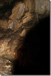
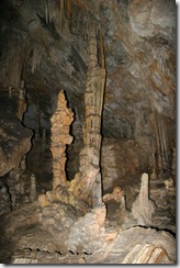
Lewis & Clark Caverns 05 Lewis & Clark Caverns 06 Lewis & Clark Caverns 07 Lewis & Clark Caverns 08

Lewis & Clark Caverns 10 Lewis & Clark Caverns 11

Day 53 - Sunday

Today we took a drive into the past.

People have lived in southwest Montana for the past 12,000 years. Some of the native tribes that lived in, hunted Virginia City  15in, or traveled through the area include: Shoshoni, Bannock, Cree, Salish, Crow, Kootenai, Pend d'Oreille, Nez Perce, and Blackfeet. Southwestern Montana was designated as common hunting ground for the Blackfeet and other tribes in 1855.

Trappers, miners, homesteaders and ranchers displaced in a few decades the hunting and gathering way of life that had existed here for thousands of years.

The discovery of gold in Alder Gulch gave birth to Virginia City. With a population of over 10,000 in 1864, Virginia City was the largest town in the inland Northwest. The communities strung out along Alder Gulch were known as the "Fourteen-mile City."

The gold rush in Alder Gulch produced the largest amount of placer gold in the Northwest an estimated $120 Virginia City  11 million. Placer gold mining, or free gold prospecting, should not be confused with hard rock gold mining. Placer mining involves dust, flakes, and nuggets, while hard rock mining involves veins of ore.

Alder Gulch yielded an estimated $30 million in gold just in the three short years between 1863 and 1866, but not everyone got rich here. The typical miner at Alder Gulch struggled, got blisters and a sore back, and barely made living wages. They would often work a few days at one job and soon quit to try another.

Virginia City  03 Virginia City was one of the main Montana stations of Ben Holladay's Overland Mail & Express Company between 1863 and 1866, later incorporated into the Wells Fargo stage coaching empire.

Camels arrived in Virginia City in 1865 for freighting. Electricity arrived in Virginia City in 1892 for lighting.

The first public school in Montana opened in Virginia City in 1866. The Madison County Courthouse was built in 1876. The first company of the Montana National Guard organized in Virginia City in 1885.

Virginia City was the home of the first newspapers in Montana. The Montana Post, printed its first issue in AugustVirginia City  14 of 1864. Today's local newspaper, the Madisonian, began publication in 1873.

Virginia City became the capitol of the Montana Territory in 1865. Thomas Meagher was the acting governor that year. Today, the capitol of Montana is in Helena.

Virginia City was the outfitting point for trips to the Yellowstone area during the 1860's and 1870's, and Virginia City served as the first administrative site for the park when it was designated America's first National Park in 1872.

Virginia City  01 Virginia City  12

Notable residents

Today Virginia City remains frozen in time with a population of around 140.

Historical Quotes:

June 11, 1865

"There was nothing visible to remind a person in the slightest degree that it was Sunday. Every store, saloon, and dancing hall was in full blast." from The Road to Virginia City - the Diary of James P. Miller

June 16, 1865

"Rained, snowed, and hailed all day. Horrible weather and very cold." from The Road to Virginia City - the Diary of James P. Miller

July 7, 1865

"News arrived this P.M. of the attack of the stagecoach going east- by road agents. Four men killed, one missing- The road agents numbered about twenty. There is a mass meeting of the Vigilantes this evening." from The Road to Virginia City - the Diary of James P. Miller

September 9, 1865

"Up half past six. Snow three feet deep and still snowing." from The Road to Virginia City - the Diary of James P. Miller

September 15, 1865

"After supper, walked to the top of Burying Ground Hill (Boot Hill Cemetery) - I enjoyed a good cigar and watched the sunset, a beautiful spectacle away to the west as far as the eye would distinguish." from The Road to Virginia City - the Diary of James P. Miller

September 27, 1865

"Two men found 'hanging in the air' this morning up the gulch a little bit with a card on their backs on which were the words 'Hung by the Vigilance Committee for being road agents'" from The Road to Virginia City - the Diary of James P. Miller

October 17, 1865

"having used the fire water rather freely, felt the effects so much that I went to bed accordingly."

"Resolved on October 22, 1865, that from this date I do not spend a cent for foolish expenses such as Billiards, Drinking or Eating, Driving, Riding, Smoking, that I limit my monthly expenses for Dancing and Gifts to $10."

October 24, 1865

"Bought a 5 gallon keg of beer, which I propose to drink for my health. Cost $2 per gallon, resolution intact." from The Road to Virginia City - the Diary of James P. Miller

December 8, 1865

"Into the sleigh and started our ride - very crowded - about 18 inside. Rode all through the streets, Took possession of several saloons. Had a carousing time." from The Road to Virginia City - the Diary of James P. Miller

Sunday, January 7, 1866

"Episcopal services in the morning. Methodist Sunday School at 2 P.M. and intended attending Presbyterian Meeting at night but, happening to be in the Occidental (Bar), I was unable to resist the temptation, losing about $20 in games and drinks." from The Road to Virginia City - the Diary of James P. Miller

February 20, 1866

"At about 8 o'clock, attracted my attention to a beautiful display of 'Aurora Borealis' or Northern Lights - the most beautiful I had ever beheld." from The Road to Virginia City - the Diary of James P. Miller

Raija & Mik 06

Virginia City Gardens

Enjoying huckleberry homemade ice cream in Virginia CityMik having Hockleberry ice cream 10

Saturday, July 11, 2009

Day 52

Today was a relaxing day in camp and a short trip to the old Parker Homestead.

Parker Homestead 03 Click to enlarge

Parker Homestead 01

Parker Homestead 02

Parker Homestead


I thought that I should compare traveling in Montana to Alaska.


Alaska

Montana

Rains a lot

Yes Yes
Mosquitoes Yes Yes
Many Rivers Yes Yes
Many Lakes Yes Yes
Muddy Roads Yes Yes
Beautiful Scenery Yes Yes
Granit Flour that gets into everything Yes Yes
Bridge to no where No Yes
High Snow Capped Mountains Yes Yes

Ah! Montana wins as they actually have a bridge to no where, Alaska did not build their bridge.

Bridge To Nowhere05Montana’s Bridge To No Where by a road to no where

Friday, July 10, 2009

Day 51

Today we continued our journey south towards Layton, UT where we will visit with our son and his family before they depart to Germany for his next Air Force assignment. As you will recall he has just returned from his yearlong Afghanistan assignment and we want to give him time to be along with his family before we visit. We haven’t seen him for over a year. We arrived at the Lewis & Clark State Park where we will spend the next seven days. It was only 89 mile trip from White Sulphur Springs.

We are now 407 miles from Hill Air Force Base.

Our route took us pass The Wheat Montana Bakery in Three Forks Montana. It looked too good to pass up. 35 dollars later we had two large cinnamon rolls, a loaf of Montana Wheat bread, Montana honey and a large jar of Montana huckleberry pie filling. As you can guess by now, I am bound and determined to have huckleberry pie. We are close to Virginia City, Montana and the last time we were there, there was a vendor that churned ice cream powered by a one cycle very old engine. So while we are here, a trip will have to be made to Virginia City for homemade huckleberry ice cream to go with the huckleberry pie.

Lewis & Clark St Park - MT 02

Lewis & Clark St Park - MT 01

LEWIS & CLARK STATE PARK

Wednesday, July 8, 2009

Day 49


We woke today to rain. Skies are overcast and a light rain has been falling off and on all day. The forecast is rain throughout the day with possibility of some severe thunderstorms. It is a nice day to just relax in the coach.

There is a town nearby by the name of Ringling. The town was a station stop on the transcontinental main line of the Chicago, Milwaukee, St. Paul and Pacific Railroad ("the Milwaukee Road"); it was also the southern terminus of the White Sulphur Springs and Yellowstone Park Railway, which ran from Ringling to White Sulphur Springs. Ringling served as a community center for ranchers and homesteaders in the vicinity, but the town's population declined throughout most of the twentieth century as the region's agricultural activity dwindled. Both railroad lines through Ringling were abandoned in 1980 and only a handful of people remain in the town today.

Ringling was named for John Ringling of the Ringling Brothers circus family, which once owned considerable ranchland in the area. Ringling was also president of the White Sulphur Springs and Yellowstone Park Railway.

It turns out that we are camped on the very spot that tracks were and that the ranch in front of us was owned by the Ringling Brothers Circus and used to park the circus rail cars and house the animals during the off circus season.

Monday, July 6, 2009

Day 47

Today we took a loop drive north of White Sulphur Springs through the Castle Mountains on a forest road and came back to White Sulphur Springs from the south.

Deer 12Deer along the way 

The Castle Mountains district is located in the Castle Mountains southwest of White Sulphur Springs. Following the initial discoveries in the mid-1880s, the area boomed. Prospectors located about 1500 claims, of which 15 to 20 became significant producers of primarily lead and silver, with some copper, gold, manganese and iron. The most important, the Cumberland mine, was the state's largest producer of lead in 1891. High transportation costs cut into mine profits, and the financial panic of 1893 dealt the final blow to the isolated district. Most of the mines closed down, never to reopen. Others produced sporadically on a small scale at least through the 1950s (Roby 1950; Winters 1968; Wolle 1963).

 Castle Mountains 01   Castle Mountains 02

Near the top of the Castle Mountains


The drive took us through the old mining town of Castle.

Castle Town 03

The best-known resident of Castle Town was most likely Calamity Jane. She came to town to

open a restaurant and lead a lady like existence. She eventually return to Deadwood in the Black Hills where she was welcomed back home and continued to be the Calamity Jane everyone had come to know.

Castle Town 04 Castle Town 05 Castle Town 08

 Remaining Castle Town Buildings

Smith River Valley 15

Sunday, July 5, 2009

Day 46


Yesterday’s 4th of July celebrations started with an ice cream social and yes they did have the elusive huckleberry ice cream plus I was able to purchase several Montana Huckleberry Chocolate bars. Now it is a good thing that the grandchildren do not care for huckleberry chocolate bars so there is no need to carry them all the way to Utah.

The ice cream social was followed by the Conestoga Campground Duck races.

And they are off 01 Race 1 1st strech 02 Halfway 03 Finish Line04

Now Montana being a free state and one that trusts it citizens to do the right thing and take personal responsibility, does not prohibit its citizens from purchasing their own fireworks. The town’s people gathered in the ball park and the people celebrated the Forth with their own fireworks and then at 10:30 the local volunteer fire department joined in with a larger display of fireworks. It was one of the best firework displays that I have ever attended.

Saturday, July 4, 2009

Day 45

Big Belt Mtns 01 Big Belt Mountains Across the Valley from the RV Park.

Helena, MT is on the other side of the mountains. The mountains are still snow capped.

White Sulphur Springs Downtown An advantage of being retired is that one can stay put during the holidays and not complete with the holiday traffic. I made an exception today and went into town to find a car wash. As you can see, traffic was really heavy.


Old Railroad Station 04


The car wash was on the very north. After washing the Hummer, I drove south about 10 blocks to the end of town. The old railroad station was at the very south end. No sign of any tracks but there are a few abandoned rail cars with nowhere to go anymore. I then preceded a block east in search of the one grocery store hoping to find huckleberry ice cream. I did manage to find the grocery store but no huckleberry ice cream.


Wht Sulphur Springs Castle 02 A couple of blocks west of Main Street (US 89) at the western edge of town is the Castle. The Castle' is an imposing mansion built in 1892 by Bryon Roger Sherman, and is now the home of the Meagher County Museum. The mansion has twelve rooms all laid with hardwood floors and covered with Belgian and Oriental rugs. In the bathrooms were washbowls and stands of Italian marble, and the light fixtures were of crystal and brass. The Victorian landmark is made of hand-cut granite blocks hauled by oxen from the nearby Castle Mountains.

Sherman installed a large water tank in the attic, supplied by pump from a windmill in the northeast corner of the yard. In 1894 he enlarged a pond on his ranch that was fed by an abundant spring, and laid a twenty-inch pipe about 150 yards down the hill to a two-story electric light plant that had two dynamos in the basement. The electricity was carried into town on bare wire strung on pine and spruce poles. The plant could run only about six hours before the pressure of the pond became too low. Consumers learned to plan their activities around the 'on' hours, but they could lay claim to living in one of the first towns in the state to have electricity.

Sherman didn't live in his stone castle too many years before retiring and moving to California.

Friday, July 3, 2009

Day 44

We headed south today along scenic route US 89 in Montana to White Sulphur Springs. We traveled just 100 miles through rolling hills and mountains. We also managed to find the rain again so no pictures. I do want to back track along US 89 in the Hummer after the 4th weekend so look for pictures early next week of the route traveled today.

We are staying at the Conestoga Campground in White Sulphur Springs. It is a RPI resort that we are members so the cost per night is only $10 with full hookups.

Tomorrow evening they are having having duck races, huckleberry ice cream and fireworks to celebrate July 4th. No huckleberry pie through as huckleberry season is still a bit off.

White Sulphur Springs is the county seat and was one of the original counties in Montana. White Sulphur Springs was the headquarters for a county that included most of central Montana. The town was named because of the white deposits around the hot sulphur springs that were found there. The hot springs have been frequented by Indians for many years. Crow Chief Plenty Coups recalled pilgrimages by warriors to the medicinal mud baths. In 1886 James Brewer stumbled onto the area as the stagecoaches rumbled through the Carroll Trail. Brewer first called the spot Brewer Springs and developed the hot springs into a stage stop and resort.

The Smith River Valley, with White Sulphur Springs as its trading center, was once the home of buffalo and later of prospectors working the Castle Mountain lead and silver mines. Since the days of Fort Logan, White Sulphur Springs has been famous for its fine cattle. Weathered homes and out-buildings at the nearby ghost town of Castle are all that remain of the 1880s silver mining boom.

Thursday, July 2, 2009

Day 43 – Great News


Last night we had a call from our daughter-an-in-law,Jane, the Colonel had landed at Baltimore International Airport. He was met by his uncles, aunts and cousins. He will be on his way home to his family today.

Today we continued our journey around the top of our route and turned south towards Great Falls, MT. We will Whoop-Up Trailspend the night at the Flying-J in Great Falls. Our route today took us along the Old Whoop-Up Trail.

As you may recalled, we spent last night on the Blackfoot Indian Reservation. The Blackfeet know now to celebrate the Forth of July.  Or at least, they get an early start. There were fireworks all night into the early morning. This morning when we woke at 7:30, there was not a sole in sight, not even a Blackfoot dog.


Click to enlarge

Wednesday, July 1, 2009

Day 42

We are on the road again. This morning we departed Marion, MT for Great Falls, MT. We arrived at Browning, MT about 3:00 PM and decided that it was time to call it a day. Browning is the capital of the Blackfeet Indian Tribe. There is a excellent museum that covers the history of the plains Indians and the Blackfeet.

We are staying at the Blackfeet Indian Casino that allows overnight RV parking. There is no charge to spend the night.

We had a great visit with our friends over the past week.

Middle Flathead River

Middle Flathead River along US 2 01

Middle Flathead River along US 2 02 Middle Flathead River along US 2 04


Middle Flathead River along US 2 05 US 2 just south of Glacier National Park