Thursday, November 19, 2009

Day 16 – Padre Island, TX – Gulf Coast / Rio Grande Trip

No Travel Mileage Today

Today we explored Padre Island.

IMG_0003Padre Island is located along the south Texas coast. Padre Island National Seashore protects the longest IMG_0002 undeveloped stretch of barrier island in the world. There are 70 miles of sandy beaches, most of which one can drive right along the water’s edge.


IMG_0005

Four nations have owned Padre Island at different times. The first was Spain, which owned Padre Island from its back-country-dunes-near-GriIMG_0001 entry into the New World until the Mexican Revolution of 1820. Following the revolution, Mexico owned Padre Island from 1821 until 1836, when the newly formed  Republic of Texas claimed the area between the Nueces river and the Rio Grande. Padre Island was under ownership by the Republic of Texas until its territory was acquired by the United States, following the War with Mexico of 1845-1848. Throughout these times, the island has been known by several names, with Padre Island being only the most recent. It has also been known as "la Isla Blanca" (White Island) and "Isla de los Malaguitas" (Island of the Malaquites, a band of the Karankawa people). 


The first permanent settlement on the island was located on the island's southern tip.  This area was established  IMG_0006around 1804 by a Spanish priest,  Padre Nicolas Balli, after whom the island is named. Prior to then, the only people known to have inhabited or visited the island were nomadic hunter-gatherers Native Americans, Spanish troops or ships, and the survivors of three shipwrecks on the island's shore in 1554.


Lunch today was at Snoopy’s Pier. Don, Karen and I had fried oysters. I also had a side order of fried okra. Raija had a  combination plate, fried shrimp, fish, oyster and french fries.

Wednesday, November 18, 2009

Day 15 – Gulf Waters RV Resort, TX – Gulf Coast / Rio Grande Trip

No Travel Mileage Today

IMG_0012This morning we drove into Port Aransas to meet the Polly Anna shrimp boat coming IMG_0013back from it’s night of shrimping. We had asked yesterday where was the best place to purchase shrimp and were told to go to the Polly Anna. They were sold out but the captain told us to come back today at 9 AM. The Polly Anna arrived in dock around 9:30 AM and sold their catch directly from the boat. We purchased 10 ponds of large shrimp for $6.00 per pound.

The shrimp are very fresh as some were still a live.

 IMG_0016 

Don busy cleaning his shrimp purchase. Tonight we will have a group shrimp dinner. I am cooking a batch Maryland style using Old Bay seasoning and Don will sautéed shrimp in butter and garlic. We should have quite a shrimp feast along with corn on the cob. The ladies in the RV Park are baking pies and we are invited to pie night, which will be our desert.


IMG_0017 

Raija and Karen are checking out the fishing possibilities.


IMG_0008Port Aransas

Day 14 – Gulf Waters RV Resort, TX – Gulf Coast / Rio Grande Trip

No Travel Mileage Today

We arrived at Gulf Waters RV Resort yesterday. This will be our home for 7 nights. The RV Resort is on Mustang Island about 5 miles from Port Aransas. From here we will explore Mustang Island, Padre Island and Corpus Christie plus indulge on fresh seafood as much as possible.

IMG_0001IMG_0002  
Gulf Waters RV Resort is owned by individuals. The owners have their own lots for their RV and car. Each lot is decorated, landscaped, by the owner. When the owners are not using their lots, they rent them out to people like us.

IMG_0004It is just a short walk to the beach.

IMG_0007 IMG_0006  
Mik & Raija enjoying the beach.

IMG_0005
One can drive on the beach almost the entire length of the island.

Monday, November 16, 2009

Day 13 – Mustang Island, TX – Gulf Coast / Rio Grande Trip

Day's Travel mileage 36 total mileage to date 1143 miles

We spend yesterday relaxing in camp on Goose Island.

Today we moved to Mustang Island and will spend a week at Gulf Waters RV Resort while we explore Port Aransas, Mustang Island and Padre Island.

Our route of 36 miles included taking the ferry across the Corpus Christi Channel. Mustang Island is surround by Corpus Bay on the west and the Gulf of Mexico on the east.


IMG_0001Our ferry boat debarking vehicles from across the channel.

IMG_0003   
As we approached the ferry, the GPS directed announced “Board the ferry” and as we approached the opposite shore the GPS announced “Depart the ferry”.

IMG_0004
Ferry passing in the opposite direction.

IMG_0007
Approaching Port Aransas.

IMG_0008 
Dive bomber in front of ferry.

IMG_0010
Preparing to dock.

Saturday, November 14, 2009

Day 11 – Port Aransas, TX – Gulf Coast / Rio Grande Trip

No Travel Mileage Today

Last night we sample some of the local cuisine at POP’S Tavern. I had a fried oyster basket and Raija had a fried flounder basket.

We took a leisurely drive through Fulton and Port Aransas. We decided to check out the ferry for our relocation to Mustang Island on Monday. It looks very doable especially compared to the ferry crossing at Dawson City in the Yukon. Taking the ferry saves us about 40 miles, which cuts our relocation to Gulf Waters RV Resort in half.

IMG_0001Large barge taken from inside Hummer while we were on the ferry.

IMG_0002
View through the windshield of the Hummer

Lunch was at the Oceans of Seafood. I had oysters on the half shell and Raija had the fried shrimp and fish.

IMG_0004The town of Fulton was named after George Ware Fulton (1810 – 1893). The Fulton mansion “Oakhurst” was built between 1874 and 1877 by George and his wife, Harriet. The three story home is of plank wall construction with a shell aggregate  concrete basement. The Fulton family lived here until 1895.

IMG_0007Raija felt a sudden urge to go to church so we stopped at the Maris Stella Chapel on Goose Island. It is a beautiful small chapel with a view to the bay.  

Friday, November 13, 2009

Day 11 – Goose Island, TX – Gulf Coast / Rio Grande Trip

No Travel Mileage Today

This morning I fell into the Gulf. I thought that I would take Mik to the water. There are some steps that lead into the Gulf by the coach. What I didn’t realize was the steps below the water are slimly and very slippery. My feet went out from under me and the only thing to do was let go of the leash and belly flop into the water. I looked back and there was Mik looking at me. At least the water was not cold. So now I can add the Aransas Bay to the long list of waters that I have been in.

We spent today doing some chores around the motor home and exploring Goose Island.

Goose Island State Park is surrounded by the St. Charles and Aransas Bays, is located north of Rockport in Aransas County. The park was acquired in 1931-1935 by deeds from private owners and Legislative Act setting aside the state-owned Goose Island as a state park. The earliest park facilities were constructed by the Civilian Conservation Corps in the early 1930s.

IMG_0001 Goose Island is home to the "Big Tree" named State Champion Coastal Live Oak  in 1969, is thought to be one of the largest in the nation. Estimated to be  over 1000 years old, the "Big Tree" has a circumference of 35 feet, is 44 feet in height and has a crown spread of 90 feet.IMG_0004


IMG_0005


Many smaller live oaks reported to be off springs of the “Big Tree” surround their 1000 year parent. Live oaks are oak trees that have leaves year round.


IMG_0006Both the white and brown pelicans are common throughout the island.IMG_0007


Egrets feed just across from our camp site in a marsh lagoon.IMG_0008  

Cruise Ship


Our coach is so close to the water that sitting on the couch looks as if one is on a cruise ship. The waves constantly lap at the shore line and sound as if the a beating up against the ship. At night the only sound to be heard is the waves lapping against the shore. If we get any wind, I am sure it will feel as if we are in a ship rocking back and forth.

Thursday, November 12, 2009

Day 10 – Goose Island, TX – Gulf Coast / Rio Grande Trip

Day's Travel mileage 172 total mileage to date 1107 miles

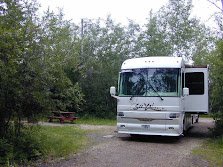
We finally made it to the Texas Gulf Coast. IMG_0005As you can see camp is set up and we will spend the next 4 nights here. Monday we will locate about 90 miles farther south on the coast.

Goose Island State Park is located at the southern tip of Lamar Peninsula amid the bays and estuaries of the Texas IMG_0006Gulf Coastal Bend. The mainland portion of the park is comprised of a live oak, red-bay woods which contain yaupon  holly, American beautyberry, coral bean and wax myrtle. Also on the mainland is a portion of tallgrass prairie consisting of bushy bluestem and saltgrass. Wildlife observation and photography opportunities include white-tailed deer, raccoon, armadillo, fox, squirrel, cottontail rabbit, and over 300 varieties of birds. The endangered whooping crane feeds on berries and blue crabs occurring in the coastal wetlands around Goose Island State Park.


The island portion of the park is an oyster shell island consisting of a shell ridge and marshland. Plants on the shell IMG_0002ridge portion of the island include sea-ox-eye daisy, wolfberry, sea purslane, baccharis and seashore dropseed grass.  The marsh at Goose Island includes smooth cordgrass, marsh-hay cordgrass, saltgrass, saltwort and glasswort. The bays around Goose Island are filled with seagrass beds and oyster reefs. Red drum, speckled trout and flounder are just a few of the fish that live in the bays around the island.

Wednesday, November 11, 2009

Day 9 – San Antonio Area


We have been lazy, for the last couple of days we have been just enjoyed relaxing at the RV park and of course walking Mik. The RV park is bordered on three sides by the San Antonio River.

We have actually been to San Antonio a couple of times before where we explored downtown, the River Walk and Noreway & Swedendinner on a river boat. Today we decided to head into down and spend some money. DemarkWe visited Institute of Texan Cultures that showed the many cultures that settled Texas. Among them were the Swedes, Norwegians and Dames.

But no Finns!


Finn
But than we did find at least one Finn, a Reverend D. N. Tillman

You can click on a picture to enlarge it.

San Antonio is like many other cities that charge for parking so you can spend money. They also make it difficult to find a place to park. It is no wonder that many of our downtowns are dying, as who wants to be nickeled and dimed to death, actual more like over $10 to park downtown? End result, instead of spending money in the shops along the River Walk and eating lunch at a restaurant, we returned to the RV park for lunch. So not only did the city not get our parking money, the shop owners and restaurants also did not get our tourist dollars.

It seems only a few states like North & South Dakota have figured out how to keep their downtowns growing as they have no parking fees and plenty of space to park in their cities.

Tower of Americas01Tower of Americas

Tomorrow we continue our journey to the Gulf Coast of Texas.


Sunday, November 8, 2009

Day 6 – Elmendorf, TX – Gulf Coast / Rio Grande Trip

Day's Travel mileage 154 total mileage to date 935 miles

We traveled in the rain and fog today from Junction to Elmendorf, Texas. Travel was somewhat slow as I-10 was full of hunters returning home from deer hunting. We saw several deer in the bed of pickups and many in large coolers with some part of the deer sticking out of the cooler. Traffic was fairly heavy as we approached San Antonio.

Elmendorf is south of San Antonio and home of Brooks Air Force Base. Lackland AFB is just of east of where are staying. Elmendorf is just 17 miles from downtown the San Antonio and is consider to be part of San Antonio metropolitan area.

We are staying at an RV Park on the San Antonio River and will spend four nights here before continuing our journey to the Gulf Cost.

Day 5 – Junction, TX – Gulf Coast / Rio Grande Trip

Day's Travel mileage 0 total to date 781 miles

IMG_0001Our Campsite By The Llano River – Junction, TX City Park

IMG_0003  
Llano River By Our Campsite

IMG_0002
Free City Park Campsite

Today we tour the town and had dinner at a Ma – Pa Texas BBQ for $10.00. We both had BBQ beef brisket sandwiches. The sandwiches were large and stacked with brisket slow cook with pecan wood.

Several people came both Saturday & Sunday to the park where we were camped to pick pecan from the ground. All of the trees in the park are large, mature pecans trees.

One can tell that it is deer season in Texas, the town is full of signs that say deer hunters welcome here. I-10 seemed to have a dead deer along the side of the road every few miles. A sign that one should not travel I-10 at dusk or during the night. I-10, I am sure, is responsible for way more deer killed then the hunters.

Friday, November 6, 2009

Day 4 – Junction, TX – Gulf Coast / Rio Grande Trip

Day's Travel mileage 194 total to date 781 miles

We will spend two nights in Junction. There is a city park on the banks of the Llano River that allows RV parking for free. Junction is named for its location at the confluence of the North and South Llano Rivers.

The internet connection is extremely slow at this location. Pictures of our camp site and more on Junction will need to wait until we arrive at out next stop on Sunday, day 6.

Thursday, November 5, 2009

Day 3 – Fort Stockton, TX – Gulf Coast / Rio Grande Trip

Day's Travel mileage 120 total to date 582 miles

We are now back to our planned stops. It was a short travel day, just 120 miles and we are spending the night in beautiful downtown Ft. Stockton, TX at the Parkview RV Park with full hookups for $10.

It seems that Texas cannot be out done by New Mexico. Ft. Stockton boasts the world’s largest Road Runner.

roadrunner Ft. Stockton Road Runner

Road Runner
New Mexico Road Runner

Raija says that the New Mexico Road Runner is larger. I think that she is right but I will let you be the judge.

Fort Stockton, the county seat of Pecos County, is on Interstate Highway 10, and the Santa Fe Railroad, 329 miles northwest of San Antonio and 240 miles east of El Paso. It grew up around Comanche Springs, at one time the third largest source of spring water in Texas, and near the military fort founded in 1859 and named for Robert Field Stockton. Comanche Springs was a favorite rest stop on the Comanche Trail to Chihuahua, the Old San Antonio Road, The Butterfield Overland Mail Route, and the San Antonio-Chihuahua freight-wagon road. The Confederates took possession of the fort at the outbreak of the Civil War but abandoned it the next year. In 1867 the army rebuilt the fort on a larger and more permanent basis to protect travelers and settlers from Indians. Until abandoned in 1886, the fort provided employment for freighters and laborers and a market for farmers, stockmen, and merchants.

Fort Stockton was garrisoned by companies of the 9th Cavalry, known as "Buffalo Soldiers." In July 1867, Fort Stockton was re-established by four Companies of the 9th U.S. Cavalry Regiment on 960 acres (3.9 km²) leased from civilian landowners, one-half mile northeast of the first post. Companies A, B, E, and K of the 9th Cavalry began construction under the command of Colonel Edward Hatch. The 9th was one of the new regiments organized after the Civil War staffed with Black enlisted men. When the 9th Cavalry was moved to New Mexico in 1875, Colonel Benjamin Grierson's 10th Cavalry took over the duties of protecting the westward migration and trade routes.

About 87 percent of all soldiers garrisoned at Fort Stockton from 1867 until 1886 were Buffalo Soldiers of the 9th and 10th Cavalry Regiments and the 41st, 24th and 25th Infantry Regiments. Native Americans called the black cavalry troops "buffalo soldiers" because of their dark curly hair, which resembled a buffalo's coat.Surmounting obstacles of harsh living conditions, low pay, and racial prejudice, they gained a reputation for tenacity and bravery. Stationed continuously on the frontier during the years of Indian hostility.

Today, the original fort's guardhouse remains, and some of the officers' quarters have become private dwellings. Several other buildings of the fort have been refurnished to the 1880s. The refurbished fort site includes a row of officers' quarters, enlisted men's barracks, and the parade grounds. A museum and visitor's center can be found at the site.

Fort Stockton is currently in a state of economic decline as oilfield production has decreased.

Wednesday, November 4, 2009

Day 2 – Van Horn, TX – Gulf Coast / Rio Grande Trip

Day's Travel mileage 191 total to date 461 miles

Road Runner New Mexico State Bird – Road Runner - No Rattle Snakes Here

<span class=Las Cruces 03" src="https://blogger.googleusercontent.com/img/b/R29vZ2xl/AVvXsEj35qm1ILugHA-Xw5s_Jo89lGnWlctuzMVFS8rDv0D_FezOTKI5x0vGHxmiVPYAw72fp9GYcplfI_A-rpV3Zyr5ovxq2B5q5ddjpPt4wRtgOXAUVSGIZwgiGUoKGB3r6wyd0Z8vKDwl1wE/?imgmax=800" border="0" width="244" height="164"> Las Cruces, NM

We traveled farther than planned today. We intended to spend the night at the Flying J east of El Paso but it turned out not to be a very good place. We refueled, topped off the propane tank and had lunch and then continued east on I-10. The two rest stops between El Paso and Van Horn were not much better so we continued on to Van Horn, TX.

Van Horn

Mesa Near Van Horn

Van Horn was settled in the late 1850s and early 1860s supportive of the San Antonio-El Paso Overland Mail route. Although U.S. Army Major Jefferson Van Horne is believed to have passed near the area in 1849 on his way to take command of what would later become Fort Bliss, the town is instead named for Lt. James Judson Van Horn who commanded an army garrison at the Van Horn Wells beginning in 1859. Lt. Van Horn's command was relatively short-lived as the post was seized by Confederate forces in 1861 and Lt. Van Horn taken prisoner. Settlement was further stimulated by the construction of the Texas and Pacific Railway in 1881.

Tuesday, November 3, 2009

Day 1 – Deming, NM – 271 Miles Gulf Coast / Rio Grande Trip


Today we traveled from Tucson, AZ to Deming, NM and will spend the night in the Wal-Mart parking lot. Why the Wal-Mart parking lot and why Deming. Well the Wal-Mart parking lot is free plus we can do our grocery shopping. As for Deming, the best Mexican restaurant, Si Senor is in Deming. People take a Sunday drive from Tucson to eat at Si Senor.

Deming is know for its annual duck races.

demingBeautiful Downtown Deming

Our first several days of travel will take us through very familar territory so the days will be just travel days as we make our way to the Gulf Coast. We will spend 2 days at Junction Texas and 4 days in the San Antonio area. More on those to places when we get there.