Sunday, June 14, 2009

Day 25

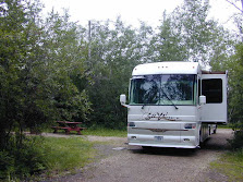
Today we woke to cloudy skies. By the time Mik was walked and breakfast was over, the rain started and lasted through noon. About 2:00 PM the rain stopped. The skies are stilled overcast but I was able to grill a rib eye steak for dinner. A break in the rain is forecast tomorrow.

The Mackay Reservoir is on the Big Lost River. The Big Lost River and the Little Lost River are so named as they disappeared into layers of porous basalt and subsurface gravels. The rivers flow underground about 130 miles to the southwest. The waters eventually surface at Thousand Springs on the Snake River in Hagerman Valley, southwest of Twin Falls, Idaho.

Homesteaders were drawn to the Big Lost Valley in the early 1900s by the promise of cheap land and speculation that a 125-foot dam would be built to irrigate thousands of acres near Arco. Although the water was badly needed, residents of Mackay feared that the dam might fail and fiercely protested its construction. A prominent engineer condemned the dam’s design in 1910, plans were scaled back and a 65-foot dam was constructed followed by a cannel system in the early 1920s.

Drought hit the area in the 1920s and early 30s. Water shortages were made worse by evaporative water loss from the reservoir and lengthy irrigation canals. By 1930 nobody was getting enough water, farms were abandoned and property values were reduced by half.

Angry Mackay farmers, desperate to irrigate their lands, dynamited the dam’s controls, releasing the entire reservoir back into the river. This supplied water locally to Mackay and stopped the irrigation through canals to farms near Arco. Resolution came in 1935 when local residents banded together and purchased the dam.

Mackay Reservoir 04 Mackay Reservoir06 New snow in the mountains & high water

The reservoir is at capacity

Saturday, June 13, 2009

Day 24


Today we traveled 144 road miles from Massacre Rocks State Park to Mackay Reservoir. As the crow flies it is only 95 miles. The Snake River and mountains sure do get in the way.

The weather was overcast the whole trip but no rain. About ¾ of the way we did our good deed for the day. At the junction of US 26 & US 20 there was a large gravel lot that we pulled into for a pit stop. We pulled alongside a red car with a young lady in it. She got out and looked at us as if she was waiting for someone. As we were about to leave, she again got out of her car and looked at us. I then asked if she was okay. It turned out she was a nurse that worked the nightshift at a Pocatello hospital and she was on her way home that is in Arco an 80 plus mile commute one-way. She was too sleepy to drive and had pulled off at the junction to sleep. When she woke, her battery was dead as she had left her lights on.  We were able to push her car alongside the Hummer and jumper the batteries to get it started.

Mackay Reservoir We arrived at Mackay Reservoir at 1:30, set up camp and had lunch. About 4:00 the downpour came. Yesterday on the local news they said that Idaho Reservoirs are now 86% to 101% full. Most are in the high 90% range with several at 100% and one at 101%. More rain is forecast through the week. Currently the outside temperature is 53. During the past week lows have been in the upper 40s and highs in the low 60’s.


The campground is on BLM land. The Golden Eagle discount with electric and water is $9.00 per night.


Lost River Range The snow covered peak is 12,662 feet. It most likely got more snow this afternoon.

Friday, June 12, 2009

Day 23


Ancient Water Falls01Ancient Water Falls – The water drain out of Lake Bonneville for 8 weeks


Pelican Rock 02 Pelican Rock 03

Pelican Rock down from our RV Site – My name for it since pelicans roost on it every day.

We finally woke to blue skies this morning. As this is our last day at Massacre Rocks, we decided to take a ride down river to Lake Walcott Reservoir. Raija wanted to see the dam and campground there. We both decided that the Massacre Rocks Campground is better.

Snake River Rapids There were some rapids in the Snake River just below the dam. They are probably similar to what the American Falls were before they built the dam at American Falls although I suspect that the American Falls was actually more of a falls then rapids.

We made it back to our camp at Massacre Rocks just before a thunder storm with hail hit. Now we are back to a steady rain. Hopefully with a little luck, it will be dry in the morning for out departure north.

Rapids below the dam at Lake Walcott

Thursday, June 11, 2009

Day 22

More rain! We woke to an overcast sky and rain showers. The forecast is for rain showers throughout the day with a break from the rain tomorrow. Idaho is several inches ahead on rain to date and the local TV stations have declare that Idaho’s drought is over.

With the rain, it was a good day to sleep in, relax in the RV and enjoy the view of the Snake River.

Wednesday, June 10, 2009

Day 21

Today’s forecast is showers throughout the day and this morning the forecast was right on so we decided to hang out at the RV, have lunch and then take a drive into American Falls. After all the name implies that there must be a falls there on the Snake River. Well there was a falls there back during the wagon train days. But with the coming of electricity someone decided that it would be a good place for a power generator plant. The first generator took advantage of the falls and the falls remained in place along with the town of American Falls.

In 1925 Idaho Power decided to build a dam for a larger power plant. Since Al Gore was not around, the dam was built and now there is no more falls. Even the town had to be moved as the original town site and old wagon bridge are now under water.


Modern Dam


Old Power House


Rocks that formed the Original American Falls


Tuesday, June 9, 2009

Day 20

Our Morning Views

Note: You can click on an image to enlarge it.


We spent the late morning and afternoon investigating the historic sites in the Massacre Rocks area.

Ancient Waterfalls


The area is rich in geological history. Devil’s Gate Pass is all that remains of an extinct volcano. Ancient waterfalls that pour water into the Snake River from Lake Bonneville are just across the river from our camping site. Lake Bonneville covered much of what is today the state of Utah. The prehistoric Bonneville Flood shaped the landscape of the area, rolling and polishing huge boulders found throughout the area. For a time the flow was four times that of the Amazon River. It was the second largest flood in the geologic history of earth.


The Oregon Trail parallel the Snake River as the emigrants continued their journey west from American Falls.


Register Rock is home to a huge boulder that holds the signatures of Oregon Trail emigrants who stopped for the night before continuing on their journey.


Monday, June 8, 2009

Day 19

We woke up at 6:00 AM to a cloudy sky but no rain. We skipped breakfast, made the coach ready for travel, hooked up the Hummer and hit the road for out next stop, Massacre Rocks. North of Salt Lake City, past any rush hour traffic, we had breakfast at the first available rest stop. Then it was on to the Flying J at Snowville, UT just before the Idaho border. Massacre Rocks is only 168 miles from Charlie’s. We arrive just a little past noon. Registered, dump the holding tanks, had lunch and then set up camp. The state park has an old farts half price discount Monday through Thursday so it is $10.61 a night with 50 amps electric and water.

The park is on the Snake River and as you can see, we have bird’s eye view of the Snake.


The name “Massacre Rocks” was coined during the 1920’s, after an Indian skirmish with 2 pioneer emigrant wagon trains on August 9, 1862.

The emigrant traffic on the Oregon Trail was well established by 1862. Most wagon trains were fairly small with only 10 to 15 wagons and a following of extra stock. There were many trains, usually only a few miles apart.

On August 9th in sequential order from Massacre Rocks back to American Falls were the Smart wagon train, the Adams Train and the Kennedy Train. The Smart Train was attacked first just a half a mile east of Massacre Rocks. The Adams Trained was attacked next as the Indians can upon it on way back to their camp. During the 2 attacks 5 white men were killed.

The next morning, August 10th, Captain Kennedy and 35 men started in pursuit of the Indians. They came upon the Indian camp just south of the present Indian Springs Natatorium location. They fought for about 3 miles as Captain Kennedy and his men tried to retreat. Two more of the white men were killed, several wounded and 2 were presumed dead.

This brought the total number of white men killed to 9 including those thought to be dead. Five of the men believed to be buried in the Massacre Rocks area are: A. J. Hunter and Masemo Lepi from the Smart Train; George Adams, Charles Bulwinkell and George Shepherd of the Adams Train.

On August 11th one of the missing men was found at the place of the first skirmish, but farther down the trail lying near a large rock. It is believed that this man was fishing for food when the attack begun on the Smart Train.

Finally, the wounded daughter of Captain Adams died the evening of August 11th and was buried the next morning, thus bringing the total number of emigrants killed to ten. The number of Indian fatalities if any is unknown.