Day's Travel mileage 102 total mileage to date 1715 miles
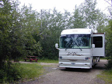
Our original plan stop for today was Amistad National Park on Amistad Lake however the park road was flooded. It seems that we continue to end droughts doing this years travels. It is also a rainy day and only 47 degrees. It would have been dry camping at Amistad and without the sun, no solar power so decided to proceed to Seminole Canyon State Park and spend the night there where there is electric hookup and we can run the heat pumps.
Seminole Canyon State Park was acquired by purchase from private owners in 1973 - 1977 and opened in February 1980.
Early man first visited this area 12,000 years ago, a time when now-extinct species of elephant, camel, bison, and horse roamed the landscape. The climate at that time was more moderate than today and supported a more lush vegetation that included pine, juniper, and oak woodlands in the canyons, with luxuriant grasslands on the uplands. These early people developed a hunting culture based upon large mammals, such as the mammoth and bison. No known evidence exists that these first inhabitants produced any rock paintings.

Despite the struggle for survival, some of these prehistoric people found the creative energy to paint the pictographs found in Fate Bell and other rock shelters of the Lower Pecos River Country. The distribution of this distinct style is limited to a district which includes a portion of the Rio Grande, Pecos, and Devils River. More than 200 pictograph sites are known to contain examples of their style of rock paintings ranging from single paintings to caves containing panels of art hundreds of feet long. Although numerous figures or motifs are repeated in different locations, the exact meaning of the paintings is buried with the people who painted them.
The first known European in this area was Castano de Sosa, who set out from Monciova Mexico, in 1590 and traversed much of present Val Verde County en route to New Mexico. The U. S. Army was the first American presence in the Lower Pecos. In 1851, Lieutenant Nathaniel Michler made a reconnaissance of the Rio Grande above and below its junction with the Pecos for the United States and Mexico Boundary Commission. After the Civil War, Lieutenant Bullis and his Seminole-Negro scouts operated in the area, and Bullis blasted a wagon road into the Pecos Canyon near the Rio Grande to provide the military with a shorter route between Forts Clark and Davis.
In 1882, construction of the Southern Pacific Railroad reached the present park location. The route to connect El Paso with San Antonio was begun after the merger of the Galveston, Harrisburg, and San Antonio Railroads with the Southern Pacific. The section of railroad in the canyon of the Rio Grande was finally abandoned in 1892, when a new bridge spanning the entire breadth of the Pecos River Canyon was completed. The present bridge was built at the same site during World War II.

No comments:
Post a Comment