Tuesday, August 31, 2010

Day 107 – Radium Hot Springs

August 31, 2010

I decided to rent the internet cable modem for one more day to finish catching up on all the online necessities that were left unattended by nine days or so without internet access. Besides it was another rainy day so it was a good use of time indoors, in the coach. It should also be fast enough to watch an online Netflix movie tonight.

Nothing else to report on today, just a few minor repairs, laundry and other chores accomplished.

Monday, August 30, 2010

Day 106 – Donald BC to Radium Springs BC

August 30, 2010

Today’s Mileage: 81
Total Mileage to Date: 8388
Mileage to Home: 1707

Day 95 was the last day posted until today so go back to day 96 for videos of bears and a cub catching salmon at Hyder AK and day 104 for howling wolves at Golden BC plus the other missed days.

I forgot to mention that the other night low was 30 degrees F and the high was only 47 F. Today was a little better, the morning low was 43 F and today’s high in Radium Springs was 59 F.

We are now back at Radium Valley Vacation Resort in Radium Springs, BC. Radium Valley Vacation Resort was our first stop in Canadian back in May when we started our journey. We will spend 3 nights here and then cross back into the US at Eureka, Montana.

We can even get Montana Kalispell’s NBC station here via the RV Park’s cable connection so now we are able to watch local and national news again.

Our WiFi luck continues to haunt us. The WiFi was fairly good in May but now the signal is weak and the data rate is very slow. Fortunately they had an alternative, rent a cable modem for $5 per day. It is not quite as fast as one would expect a cable connection, 1.39 Mbps download and 0.480 Mbps upload. Well at least I seem to be making some headway on uploading the blog videos and posting previous blogs.

Next diesel fill up will be in Montana, bye to Canada’s $4 plus diesel & gas prices.

Day 105 Campers Haven RV Park – Donald BC

August 29, 2010

Today is our last day at Donald’s Campers Haven RV Park. I am not sure if Donald is even a town or just a dot in the road as we never did find a town. The RV Park is a nice place to stay. It has good scenery as it is surrounded by mountains although while we were here the mountains were hidden by low clouds.

In the afternoon, we drove 15 miles to Golden for groceries. I spotted a Best Western and a Ramada Inn so it was off to the Best Western’s parking lot to see if they had open WiFi. One needed a code from the front desk so it was off to the Ramada’s parking lot. WiFi luck at last, the Ramada’s WiFi was open to all. We downloaded our email for the first time in about nine days.

Next it was off to the grocery store and then back to Donald to get ready for a travel day.

Day 104 – Wolf Centre Golden BC

August 28, 2010

Northern Lights Wildlife Wolf Centre is located in Golden, BC. The Centre promotes wolf and bear conservation.

The wolves of Northern Lights have all been adopted from various facilities. Born and bred in captivity, the wolves are not candidates for release into the wild. Each wolf has been socialized (imprinted) from a very young age. This allows Northern Lights to use them for education and photography. It also makes their lives in captivity less stressful, since people do not make them nervous.

IMG_0727 
Tyler, Maya & Tuk

Wolves howling video

IMG_0731 
Karelian Bear Dog

Today Karelian Bear Dogs are used to protect bears by scaring bears away from urban areas. The Karelian Bear Dogs have no fear of bears as they were originally bred to hunt bears. In Russia and the Scandinavian Countries the dogs were used to locate bear dens in the winter while the bears were hibernating. The dogs would enter the den, attack the bear, waking it up, and chase the bear out of the den to the waiting hunters.

Click here to go to Northern Lights Wild Life Centre.

Day 103 – Lake Louise BC to Donald BC

August 27, 2010

Today’s Mileage: 68
Total Mileage to Date: 8307
Mileage to Home: 1787

Still no internet service but at least tonight in the campground, we do have cell phone service.

Today was just a short hop over the mountains to Donald BC to see wolves. The RV Park advertised internet but for some reason it does not connect if one is running Vista. They have Hughes-Net and the company / person that configured the router is in Mexico and they have not been able to correct the problem. So it looks as if we will have to wait for Radium Hot Springs for internet service.

The drive was mostly through rain that limited some of the better scenic views. Below are pictures and video taken during today’s drive.

IMG_0711


IMG_0713


IMG_0717

Day 103 Drive Video

Day 102 – Mount Robson BC to Lake Louise BC

August 26, 2010

Today’s Mileage: 198
Total Mileage to Date: 8239
Mileage to Home: 1854

Still no internet service but at least tonight in the campground, we do have cell phone service.

We departed the Yellow Head Highway, 16, and headed south on the Icefields Parkway, Highway 93. The stretch of highway that we traveled starts in Jasper, Alberta and ends at Lake Louise. One passes down the center of the Canadian Rockies.

IMG_0702 
Columbia Glacier

IMG_0706 
Young Cow Elk

IMG_0708 
Bow Lake

Day 102 Video

Day 101 – Mount Robson

August 25, 2010

Like yesterday, we are still without cell phone and internet service.

Today was spent just relaxing, a small hike and enjoying the view.

IMG_0700
Mount Robson

IMG_0701 
Canadian Rockies

Tomorrow we will turn south at Jasper, Alberta and work our way a little farther towards home.

We should have at least some cell service along the way but probably will not have internet service for another day or two. It will be nice once we are back in the states where I can use my Verizon data card to connect to the internet.

Day 100 – Prince George BC to Mount Robson BC

Today’s Mileage: 183
Total Mileage to Date: 8041
Mileage to Home: 1986

It would appear that we may not have internet service until we get to Radium Hot Springs unless we locate a WiFi hotspot in Jasper. We are now in Mount Robson Provincial Park near the base of Mount Robson. There is no cell service here either. We did have cell phone service along Highway 16 but lost it near the entrance to the park.

Mount Robson is the highest mountain, 12,972 feet or 3954 meters, in the Canadian Rockies.

Day 99 – Telkwa BC to Prince George BC

Today’s Mileage: 219
Total Mileage to Date: 7858
Mileage to Home: 2168

We still do not have internet so this posting too will have to wait for another day. There are quite a few WiFi stations in the area but they are all secured. Gone on the days when one could tap into someone’s unsecured wireless router.

Today we continued east on BC 16, the Yellow Head Highway to Prince George where we will spend the night in the Costco Parking lot.

Today’s drive was somewhat smoky has BC has quite a few forest fires. Other than the smoke the drive was uneventful.

Day 98 – Hyder Alaska to Telkwa British Columbia

Today’s Miles: 217
Total Miles to Date: 7639
Miles Remaining: 2385

August 22, 2010

No internet so this update will be posted another day.

We left Hyder Alaska and Alaska for the last time. Our route was back along BC 37A to BC 37, the Cassiar Highway to BC 16, known as the Yellow Head Highway.

Now just when one might think that we would be through with glaciers, I found one more to photograph along the way. It lies between Hyder and the junction of highways 37 & 37A.

IMG_0696 
Bear Glacier

The terminus of Bear Glacier is near the edge of Highway 37A. The lake is formed from the glacier runoff. There is a natural dam on the lake and the water then flows into Bear River. Smaller glaciers also add to the flow of Bear River as it makes its way into the Pacific Ocean.

We are just a little pass Smithers BC in a small community of Telkwa and are spending the night at Fort Telkwa RV Park.

IMG_0699 IMG_0698
Bulkley River views from our RV Camping Site


Day 97 – Camp Run-A-Muck Hyder Alaska

Tomorrow is the start of several travel days so today is being spent as a camp day doing cleaning, laundry, emptying tanks and running the Reverse Osmosis to fill the fresh water tank. There is a fairly good chance that we will end up drying camping over the next several nights. We will also probably be without internet service for a while but hopefully we may have cell phone service once we get to Canada’s Yellow Head Highway.

Tonight we will have dinner at “The Bus” in Hyder. It is a very, very, old bus without tires, etc., but is reported to have very good fish & chips.


Day 96 – Salmon Glacier & Fish Creek

August 20, 2010

In the morning we stopped at Fish Creek to see if there were any bears. As usual, we had just missed one.

IMG_0646

Above & Below Fish Creek Bear Viewing Platform

IMG_0645


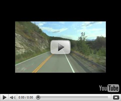
We hung around to 11:00 AM but no bears so was it decided to proceed to Salmon Glacier. The road to Salmon Glacier is the same dirt road that starts in Hyder and goes to Fish Creek. Just a few miles farther up the road, one crosses back into British Columbia. There is just a sign that “Welcomes You to BC”. The road is an old mining road that was used to transport miners to and from the mines in BC.

IMG_0648 
Old mining buildings

There is some new exploration in progress due to the high price of gold.

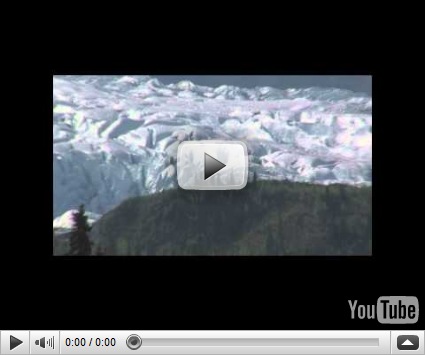
The Salmon Glacier is the fifth largest glacier in North America. Salmon Glacier is a potential major natural hazard. Summit Lake is located at the northern end of the glacier and every year around mid-July the lake breaks an ice-dam and then flows under the Salmon Glacier into the Salmon River. This causes the river to rise approximately 4 – 5 feet for several days.

IMG_0649
One Terminus of Salmon Glacier

IMG_0650
Near the Peak of Salmon Glacier

IMG_0651  
Second Terminus of Salmon Glacier

IMG_0655 
Third Terminus of Salmon Glacier

Salmon Glacier Video

IMG_0657 
Smaller Glacier 17 miles up the road from Salmon Glacier

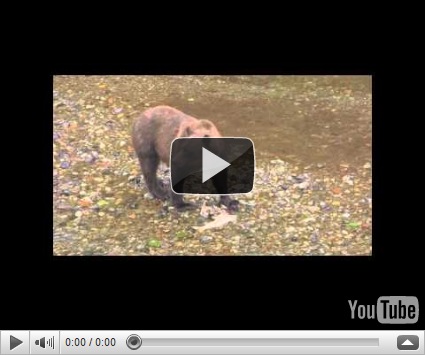
On the way back from Salmon Glacier, we again stopped at the bear viewing area. This time, we had better luck. Myra and her spring cub came to try their luck at salmon fishing. They were quite successful.

IMG_0674
Myra and Her Cub

IMG_0678 
Cub decides mama’s fish is better

The cub has not been named by the Forest Service yet has they do not know its sex.

IMG_0679 
Myra is off to catch another salmon


IMG_0686

Mira decides to depart the area to protect her cub from Dog Bear, a male grizzly.

As the bears move up and down stream looking for fish, the onlookers follow them on the platform. In the video you will hear people talking along with the sounds of the stream, the bears in the stream and even the bears crunching the salmon.

Myra & her cub video

IMG_0688 
Dog Bear

Dog Bear is a battled scared, adult, male grizzly. While he is in the area no other bear will approach. He picked up the cub’s scent and checked out the places where Myra and the cub fed on their catches in the brush. He caught several salmon and ate them in the brush along banks of Fish Creek. Male grizzlies will kill cubs if they catch them. The mother will send the cubs up a tree that the male is unable to climb and lead the male off. The cubs will stay in the tree until the mother returns.

Dog Bear wondered off and about five minutes later Monica made her entrance but left quickly without fishing as she must had caught Dog Bear’s scent.

IMG_0693 
A Blue Heron observing action from a nearby tree

Dog Bear, Monica & Blue Heron Video

Friday, August 20, 2010

Day 95 Hyder & Stewart

August 19, 2010

In the morning it was off to see if there were any bears fishing for salmon in Fish Creek.

IMG_0642
Blue Pond from glacier runoff by Fish Creek

IMG_0643
Male Salmon left discarded by the bears.

Both grizzly and black bears often come to this area to feed on chum and pink salmon in the shallow waters of Fish Creek. The Forest Service built a platform over the creek so people can view and photograph the bears feeding on salmon. The bears generally only want the female salmon for the roe. They often only eat the roe and skin. They cannot tell the males from females until they catch a fish. If it is a male, the bears will discard the salmon but it is already fatality wounded.

We waited a couple of hours and when no bears showed up, we drove around Hyder AK and Stewart BC.

IMG_0644
A central street in Stewart

Stewart Video

Stewart BC is a larger then Hyder. Stewart’s population is around 700 while Hyder’s is around 100. Stewart also has paved roads and Hyder does not.

IMG_0640
IMG_0641 
Hyder Alaska

Hyder Video

We went back to Fish Creek around 4:00 PM and stayed until 8:00 PM. This time we had better luck. Monica, a female grizzly, came to try her luck. She caught one salmon, ate it in the brush and then left. I missed filming her catching and eating the salmon but I was able to film her entry and exit.


Monica’s Video

The Forest Service named her Monica as she hanged around a male grizzly for a while that was named Bill.

Thursday, August 19, 2010

Day 94 – Rabid Grizzly Rest Area to Hyder Alaska

Today’s Miles: 265
Total Miles to Date: 7422
Miles Remaining: 2602

The road was in fairly good shape so we made it to Hyder, Alaska today.

There has been no cell phone or internet service over the entire route of the Cassiar Highway. We are now at Camp Run-A-Muck RV Park in Hyder. There is no cell phone service here either but the RV Park does have a WiFi Internet service but it is extremely slow.

Steward British Colombia is at the head of the Portland Canal on the AK-BC border. Hyder is 2.3 miles beyond Steward. The only land access to Hyder is through Canada via Canadian Highway 37A, a spur of the Cassiar Highway 37. One must pass through Steward to get to Hyder. There are no banks in Hyder so people and businesses in Hyder, bank in Steward. Therefore Hyder uses Canadian currency. There is a U.S. Post Office in Hyder.

A narrow saltwater fjord approximately 90 miles long forms a national boundary between Alaska and Canada. Prior to the coming of the white man, Nass River Indians new the head of the Portland Canal as “Skam-A-Kounst”, meaning safe place.

In 1896, Captain Gatland explored Portland Canal for the U. S. Corp of Army Engineers. The Stewart brothers arrived in 1902 and in 1905 Robert M. Steward, the first postmaster, named the town Steward. Hyder was first called Portland City. It was renamed Hyder, after Canadian mining engineer Frederick B. Hyder when the U. S. Postmaster told residents that there were already too many cities named Portland.

Gold and silver mining dominated the area and Hyder became an access and supply point for the mines while Stewart served as the center for the Canadian mining activity. Hyder’s economy today is mainly tourism with a little mining and forestry.

Day 93 –Cassiar Highway & Alaskan Highway to Rabid Grizzly Rest Area

Today’s Miles: 128
Total Miles to Date: 7157
Miles Remaining: 2887

There is no cell phone service or internet service at this overnight location, so like yesterday, today’s blog will have to be posted another day.

We lucked out and were able to join the 10:00 AM convoy through the forest fire area.

IMG_0629
Convoy starting to enter heavier smoke

IMG_0630 
Convoy is entering burned area

IMG_0633
Now in burned area, small fires are still visible on both sides of road

IMG_0634 
Starting to exit burned area

IMG_0635 
Out of burned area

IMG_0638 


Pilot car has left convoy and vehicles are spacing apart

 Convoy Video

Our first stop after we were free from the convoy was Jade City, population 50 in the summer and around 10 in the winter months. Jade City earned its name as a commercial outlet for Jade mined from the nearby mountains. The Princess Jade Mine located just 90 miles from Jade City in the Cassiar Mountains, accounts for 90% of world’s jade supply. One can purchase jade jewelry, jade carvings and jade rocks at Jade City. Jade rocks are sold by the slice or any tonnage you desire.

Jade City Video

After lunch and some purchases, we traveled another 50 or so miles to the Rabid Grizzly Rest Area that overlooks Dease Lake. We are now within striking distance of Hyder, AK provided the remaining portion of the highway is good. One never knows about the highway conditions or delays due to construction here until you come upon them. Maximum speed on the Cassiar is 80 KMPH. Frost heaves often slow you to less than 40 MPH.


Day 92 – Whitehorse Yukon to Junction of Cassiar Highway & Alaskan Highway

August 16, 2010

Today’s Miles: 254
Total Miles to Date: 7029
Miles Remaining: 2995

There is no internet here and most likely we will not have internet access until we get to Hyder.

IMG_0625 
Lunch Stop Teslin Lake

We traveled a little farther than usual today. We originally planned to stop and spend the night about midway between Whitehorse & the junction of Cassiar Highway and the Alaskan Highway. When we stopped for lunch, we had 147 miles left, so we decided to just drive the rest of the way.

We are now dry camping at the junction along with many others waiting for the pilot vehicle in the morning. The Cassiar Highway is closed for approximately 71 kilometers due to a forest fire. Attempts will be made to pilot traffic between 09:00 and 18:00. There is no guarantee of any openings due to erratic fire behavior and heavy smoke. If there is a convoy in the morning, we will be back on track for Hyder Alaska.

IMG_0627
Fellow Travelers Line Up Waiting for Tomorrow’s Convoy

IMG_0628 
Others Join the Wait behind Us

The sky is hazy due to the smoke in the air. It was much worst about 25 miles before the junction when we were in a valley. The forest fire started over three weeks ago. The fire is lightning caused.


Sunday, August 15, 2010

Day 91 – Whitehorse Yukon

It is just a quiet day in Whitehorse doing a few chores in the motorhome and washing the windows on the Hummer and the front windshield on the motorhome. It seems just about impossible to get the windows clean on the Hummer and motorhome. The glacier flour coating seems to have imbedded itself into the glass.

This afternoon was grocery shopping for supplies for the return trip. Whitehorse has a Real Canadian Superstore (RCSS). The RCSS is a cross between a Costco or Wal-Mart Sam’s Club and a grocery store.

The sun is out and it made it to 81 F today. Last night’s low was 47 F. It appears that we will have warmer and clear days as we head south.

Yesterday’s BC Highway 37 report that it was still closed due to the lighting caused forest fire. It is a two days drive to the Junction of the Alaskan Highway and 37. If Highway 37 is still closed, we will continue on to Watson Lake and bypass Hyder AK and the bears.

Saturday, August 14, 2010

Day 90 – Destruction Bay, Yukon to Whitehorse Yukon

Today’s Mileage 167
Miles to Date 6775
Miles remaining to home 3249

Charlie 
In memory of Charlie who kept the Alfa Coaches in top condition.

I forgot to mention that the other night in Tok was 32 degrees F. Fall is here in the north and the colors are changing.

Our route today took us from Kluane Lake’s Destruction Bay, around the southern tip of the lake and then on to Haines Junction and to Whitehorse.

IMG_0624
Fall Colors – Southern Tip of Kluane Lake

IMG_0622
 
At last a sunny day – South Beach Kluane Lake

Kluane Lake is Yukon’s largest lake.

IMG_0621
Massive Sheep Mountain, now called Tachal Dhal

Tachal Dhal is home to Dall Sheep. In the summer, the sheep feed high up on the mountain. The winter months brings them down to the valley floor and they are often seen feeding by the roadside.

We will spend two nights in Whitehorse before continuing our journey home.

Friday, August 13, 2010

Day 89 – Tok, AK to Destruction Bay, Yukon

Today’s Mileage 224
Miles to Date 6608
Miles remaining to home 3416

We made a little more progress today. We have crossed back into Canada’s Yukon Territory and are now more than halfway to Whitehorse, Yukon. There were no problems at the Canadian Customs. Just the usual questions about firearms and what do you do for a living. Answering “retired” prompted “What did you do before you retired”. So I said that I worked for HP and he said that “we were good to go” and wished us a good day and welcome us to Canada”.

The ride was a little rough to this point. I missed seeing a series of frost heaves. They were spaced just right to bounce the coach up and down hard enough to shake the washer/dryer loose and bow the crossbar rod in tow bar. I was able to get the washer/dryer back in place and have it secured the way Alfa secured it. There is not much to do about the tow bar. I have a spare at home and I should be okay until then as long as I take it easy to Haines Junction. At that point the frost heaves will behind us and we should have good roads the rest of the way.

We are spending the night at Destruction Bay. Destruction Bay is located on the shore of Kluane Lake. Destruction Bay is one of several towns that grew out of the building of the Alaskan Highway. It earned its name when a storm destroyed buildings and materials here. Destruction Bay was one of many relay stations spaced at 100 mile intervals to give truck drivers a break and a chance to repair their vehicles. Given the present road condition, I think nothing has changed as one certainly needs a break from be bounced around and I certainly needed to do some repairs.

A repeater station was also located here, providing telephone and telegraph service. Today the RV Park that we are staying at is providing WiFi service and microwave repeater towers provide cell phone service.

We do have a good view of Kluane Lake put I am a little pooped after today’s drive and repairs to take pictures of the lake. Besides, I think that I posted some of the lake on the way up.

Thursday, August 12, 2010

Day 88 – Tok, AK


It has been a quiet somber day reflecting of the days spent at Camp Charlie and how helpful Charlie was. He was always there to answer your questions either by phone or in person. He treated all of his customers and friends like family. The Alfa Motor Home Family has truly lost one of their own.

This is our last day in Tok. As mentioned before, one must pass through Tok twice when driving via road to and from Alaska. There is only one route to take and it passes through Tok.

Tomorrow we will cross into Canada’s Yukon. Normally it is a two day drive to Whitehorse from Tok but due to the road condition between Tok and Haines Junction, most likely it will require three days. Coming up we had to drive 35 mph or slower because of the frost heave road damage.

We will most likely not have internet access until we reach Whitehorse unless we end up spending the night at a place that has WiFi. We should have cell phone service most of the time unless we end up spending the night in a deep valley.

Days 87 – Chistochina River to Tok, AK

Today’s Mileage 89
Miles to Date 6384
Miles remaining to home 3640

We arrived in Tok around noon, top off the coach with diesel and gave the coach a quick wash. We are parked by behind the Chevron Station that provides free parking and dump station if you fill up your vehicle.
We will spend two nights here before proceeding back down the Alcan Highway. Tomorrow will be spent doing more cleaning on the outside of the coach and grocery shopping.
We have a very slow internet connection and were able to receive email for the first time in two days. Sadly it brought a notice of a dear friend's passing, Charlie, owner of Charlie’s Service in Sunset, Utah. Charlie will be missed by his many friends.

Days 86 – Sutton AK to Chistochina River

Today’s Mileage 172
Miles to Date 6295
Miles remaining to home 3729

There is no internet where we are spending the night, so hopefully I will be able to post this in Tok tomorrow.

Well we did not quite make it to Tok today. The mountain grades / curves, narrow road and frost heaves made a rough, tiredly long driving day so we stop about 88 miles short of Tok to relax and spend the night. This will put us into Tok tomorrow before lunch.

The drive was very scenic, especially the portion along the Matanuska River and views of the Matanuska Glacier and Chugach Mountains. This time the clouds were high and we were able to see the glacier much better.

IMG_0611 
Matanuska River

The Matanuska River is created by the Matanuska Glacier.

Matanuska River Drive Video

IMG_0612
Matanuska Glacier

As you will recall from the our travel log going the other way, the Matanuska Glacier is over 27 miles long, with an average width of 2 miles (4 miles wide at its terminus) and 18,000 years ago it terminus was at Palmer, 53 miles from the present terminus. The glacier head is in the Chugach Mountains.

IMG_0616 Chugach Mountains

Matanuska Glacier & Chugach Mountains Video

IMG_0619 
View of Chistochina River from our Overnight Parking Site

IMG_0618
Our Mountain View from Chistochina River from our Overnight Parking Site