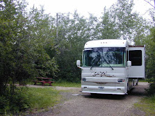
Miles Traveled Today 242
We arrived home today at 1:40 PM. There was no wind and the sky was partly sunny.
Our trip statistics are:
Total trip mileage: 2623.8
Average Speed: 46.4 MPR
Total Engine Run Time: 56.5 hours
Average MPG: 7.5
Miles Traveled Today 242
We arrived home today at 1:40 PM. There was no wind and the sky was partly sunny.
Our trip statistics are:
Total trip mileage: 2623.8
Average Speed: 46.4 MPR
Total Engine Run Time: 56.5 hours
Average MPG: 7.5
No Travel Mileage Today
The winds picked up around midnight. We only got a few sprinkles but the wind remained strong throughout the night and through today. The sky has now cleared but the coach continues to rock back and forth from the wind. The forecast is for the winds to die down this evening, so we should be able to continue our journey home tomorrow.
Miles Traveled Today 298 – Total Miles To Date 2381
The weather continues to haunt us. We had planned to spend the night just east of El Paso at the Texas Information Center. They have a large RV parking area and one is permitted to spend up to 24 hours there for free. The plan was then to travel to Lordsburg, NM and spend the night at the NM Travel Information Center that is also free. We would then be in a position to arrive home about noon on Wednesday. However, the weather forecast is for a strong front to pass through our route of travel tonight and through most of tomorrow. The wind is forecast to be 50 mph out of the west with gusts up to 70 mph. Based on the forecast, we decided to press on to Deming, NM.
We are spending the night at the LoW-HI RV Ranch. It is a Pass Port America RV Park and the cost is $15.49 for full hookups including 50 amps. We will see what the forecast is in the morning and if it is still for strong winds, we will spend a second night here to wait out the front passage. The miles let to home is 243 miles. By leaving around 9:00 AM in the morning, we will arrive home at an reasonable hour in the afternoon.
We are now two days ahead of schedule, so even if we need to sit out the storm tomorrow, we will still arrive home one day ahead of schedule.
Miles Traveled Today 146 – Total Miles To Date 2083
We departed Big Bend this morning and are now headed home. We are spending the night in Marfa, Texas at the Apache Pines RV Park. It is the a small RV Park along side the highway but it does have full hookups and cable TV.
The town of Marfa is best known for its “Mystery Lights”.
The Marfa Lights are reported to be from 1-10 feet in diameter. They are spherical and reddish-orange in color. They have been observed to vary their size and fly at high speeds. Numerous photographs and video footage have captured these lights in action. Marfa Lights are generally considered harmless. They are even rumored to have helped a lost man during a blizzard by providing warmth and guiding him home.
The ghost lights appear in many different ways to different people. Some swear they have seen them divide to form separate balls of light. Others claim that they have seen them move up and down. All agree that they glow as softly as a star at times, then brighten to the intensity of a stoplight. Sometimes they pop off and on. As they fade they seem to be receding. There are verifiable accounts of people being pursued by the lights.
Scientists have made numerous attempts to put the mystery to rest. In 1947, Fritz Kahl, a local war veteran and pilot, chased the Lights in an airplane, but came up empty. In 1975, Kahl made another attempt, this time with a team that included observers in Jeeps and planes. The "Marfa Ghost Light Hunt," as it was called, featured "more than a hundred carloads of observers gathered between the two observation points, one at Paisano Pass and the other at the entrance to the old Presidio County Airport," according to the Sul Ross "Skyline" newspaper. The searchers, "utilizing aircraft, survey instruments, multi-band radio equipment and about a half-dozen search teams," were no more successful than Kahl had been in his solo search of '47, and the legend grew.
Some believe that the lights are nothing more than high-powered lights from area ranches or the reflected headlights from nearby cars and trucks, but that doesn't explain why the Lights have been reported since before electricity or vehicles ever reached the Big Bend area. Nor does it explain why there have been reports of observers hearing a high-pitched, "tuning fork" noise in only one ear while watching the Lights.
No Travel Mileage Today
Today is our last day at Big Bend. Tomorrow we start the last leg of our trip towards home.
Today’s posting will need to wait until tomorrow’s overnight stop. Hopefully tomorrow night, we will once again have both internet and cell service.
The today’s scenic drive in Big Bend is known as the Basin Drive. It is a seven mile drive that climbs up Green Gulch to Panther Pass and then drops into the Chios Basin. Chios Basin has a campground, lodge, store and a Visitor Center. The lodge had free WiFi, via satellite, so I was able to upload the last two days of blog postings and download our email at a somewhat reasonable speed.
When we arrived at the drive’s entrance, 23 miles from our camp, the road was closed due to ice on the road. The temperature dropped down to 23 degrees F last night at the campground. Fortunately a park ranger was about to make a test run to see if conditions were safe enough to open the road. He offered to let us tail along behind his truck. The road turned out to be clear of ice and the road was opened to traffic for the day.

Legend has it that there is a church in Mexico and after Sunday mass one can look through the Window from the church and see the entrance to a lost mine located in Chios Mountains.
Big Bend is a worth while stop and one needs to plan at least 4 days to take in most of what the park has to offer. One also needs a high clearance, 4 wheel vehicle to travel many of the old roads to see the old historical sites.
No Travel Mileage Today
We did not get any snow last night but we did get a dusting of snow this morning.
The temperature forecast for tonight is in the mid 20s. Tomorrow is clear skies and warming to the 50s and then Sunday in the 70’s.
We took the Ross Maxwell scenic drive today.
The building in the picture looks like an active ranch but it was abandoned in 1945. The foreman’s house is constructed of native materials: reed ceiling from the river, timbers from the mountains and large stones from Blue Creek Canyon.

Many of the mountains in the park received a light cover of snow during the night.

Some brush and trees along the way were covered with ice.
Carousel Mountain actually looks like a carousel. It consists of magma from ancient volcanoes. Over the millions of years the softer ash and soil eroded away.
Mule Ear Peaks is another example of volcanic action and erosion in this valley .


Nearby is an area of white tuff beds and black, basaltic boulders.

Seventeen-mile long Santa Elena Canyon separates the high mesas of the massive Lower
No Travel Mileage Today.
Last night was cold and windy. The forecast for tonight is colder with a possibility of up to an inch of snow. Today was fairly overcast.
We did go exploring today and to our pleasant surprise there is quite a bit of history along with things to see.
We have no internet or cell phone service where we are camping. We were able to find a spot about 5 miles from here that is high up on a hill where I got 2 bars of single strength on the cell phone and was able to connect to the internet. The connection is rather slow so I am limited in what I can send and receive.


Our first stop was a floodplain farm house on the Rio Grande. To transform the desert into a 


Rio Grande River by old farmhouse
The route to our next stop solved the mystery. There was a pull out overlooking the river. 


Cables from Tramway
The last stop of the day took us to Hot Springs, Texas. Charles
The buildings are typical construction of time and area using native rock and local materials.
Post Office Store
Charles believed in the healing powers of the springs and encouraged tourists to sample the healing waters of the Hot Springs spa and fish for large catfish.
The Hot Spring water is considered old water, fossil water, ancient and irreplaceable. Heated by geothermal processes and emerging at 105 F, the water carries dissolved mineral salts reputed to have healing powers.
Research indicates that the hot water is emerging from a pocket of fossil water deposited at least 20,000 years ago. The ancient water is not being replaced and may one day become extinct. The temperature is 105 degrees F throughout the year. The rate of flow in 1936 was claimed to be 250,000 gallons per day. More recent measurements show a slight decrease in flow.


Ancient Indian Art by Hot Springs
Day's Travel mileage 222 total mileage to date 1937 miles
We arrived at Big Bend, one of our main goals of this trip, today. We set up camp at the Rio Grande Village National Park Campground. It is dry camping and with Golden Eagle discount it is $7 per night.
There is no cell, internet, radio or TV here. I did have cell phone coverage on the park road in spots so I will try and post this tomorrow as we drive around to take in the sites.
Big Bend refers to the great southwest Texas U-turn the Rio Grande makes here. In Big Bend National Park roads end at the Rio Grande, the boundary between the United States and Mexico. Three states come together at Big Bend: Texas in the United States and Coahuila and Chihuahua in Mexico.
We arrive too late to take pictures for this post. Look for pictures in future posts that may have to wait until we leave the Big Bend area.
12/3/09 – Found a spot on the road where I can just barely can a slow internet connection. Pictures and most things will have to wait a few days until we move on to a place with better internet connections.
Day's Travel mileage 102 total mileage to date 1715 miles
Our original plan stop for today was Amistad National Park on Amistad Lake however the park road was flooded. It seems that we continue to end droughts doing this years travels. It is also a rainy day and only 47 degrees. It would have been dry camping at Amistad and without the sun, no solar power so decided to proceed to Seminole Canyon State Park and spend the night there where there is electric hookup and we can run the heat pumps.
Seminole Canyon State Park was acquired by purchase from private owners in 1973 - 1977 and opened in February 1980.
Early man first visited this area 12,000 years ago, a time when now-extinct species of elephant, camel, bison, and horse roamed the landscape. The climate at that time was more moderate than today and supported a more lush vegetation that included pine, juniper, and oak woodlands in the canyons, with luxuriant grasslands on the uplands. These early people developed a hunting culture based upon large mammals, such as the mammoth and bison. No known evidence exists that these first inhabitants produced any rock paintings.

Despite the struggle for survival, some of these prehistoric people found the creative energy to paint the pictographs found in Fate Bell and other rock shelters of the Lower Pecos River Country. The distribution of this distinct style is limited to a district which includes a portion of the Rio Grande, Pecos, and Devils River. More than 200 pictograph sites are known to contain examples of their style of rock paintings ranging from single paintings to caves containing panels of art hundreds of feet long. Although numerous figures or motifs are repeated in different locations, the exact meaning of the paintings is buried with the people who painted them.
The first known European in this area was Castano de Sosa, who set out from Monciova Mexico, in 1590 and traversed much of present Val Verde County en route to New Mexico. The U. S. Army was the first American presence in the Lower Pecos. In 1851, Lieutenant Nathaniel Michler made a reconnaissance of the Rio Grande above and below its junction with the Pecos for the United States and Mexico Boundary Commission. After the Civil War, Lieutenant Bullis and his Seminole-Negro scouts operated in the area, and Bullis blasted a wagon road into the Pecos Canyon near the Rio Grande to provide the military with a shorter route between Forts Clark and Davis.
In 1882, construction of the Southern Pacific Railroad reached the present park location. The route to connect El Paso with San Antonio was begun after the merger of the Galveston, Harrisburg, and San Antonio Railroads with the Southern Pacific. The section of railroad in the canyon of the Rio Grande was finally abandoned in 1892, when a new bridge spanning the entire breadth of the Pecos River Canyon was completed. The present bridge was built at the same site during World War II.
Day's Travel mileage 210 total mileage to date 1613 miles
Today was one of our longer travel days. We are spending the night in the Wal-Mart parking lot and will continue our journey tomorrow. This is certainly one of the busier Wal-Marts that we had been at, especially for a smaller town. The Mexican city of Piedras Negras is just the across the Rio Grande that divides the two cities and two countries. I image that being just a few blocks from Mexico accounts for the high Wal-Mart traffic.
Eagle Pass was the first United States settlement on the Rio Grande. Originally known as Camp Eagle Pass, it served as a temporary outpost for the Texas militia, which had been ordered to stop illegal trade with Mexico during the Mexican-American War.
The United States Army established the presumably permanent Fort Duncan on March 27, 1849, a couple of miles upstream from Camp Eagle Pass. The building of the fort was supervised by Captain Sidney Burbank. It was named for Colonel James Duncan, a hero of the Mexican War. After the war, trade flourished under the protection of the fort. The fort was near the trail of westward immigration to California. It also served as an outpost against hostile Apache. It was abandoned and reopened several times. In March 1860, it served as the base of operations against the border assaults arranged by Juan N. Cortina.
Fort Duncan was held by the Confederacy during the American Civil War. On July 4, 1865, General Joseph O. Shelby, en route to offer his troops' service to Maximilian in Mexico, stopped at Fort Duncan and buried in the Rio Grande the last Confederate flag to have flown over his men. In 1870, Colonel William R. Shafter trained Seminole and African American scouts at Fort Duncan. After several decades of deactivation, Fort Duncan was activated as a training camp during World War I. In 1938, the City of Eagle Pass acquired the fort and still operates a museum and a children's library at the site.
In 1850, Rick Pawless opened a trading post called Eagle Pass. In 1871, Maverick County was established, and Eagle Pass was named the county seat. During the remainder of the 1800s schools and churches opened, the mercantile and ranching industries grew, and a railway was built.
General William Leslie Cazneau (1807-1876) founded the Eagle Pass townsite in the 1840s.
Eagle Pass Today
Yes, it was another raining day as you can see the clouds are still following us.
No Travel Mileage Today
We drove around the park today and tried to go to the dam. We were unable to get close to the dam as the road proceeds across the dam to Mexico. There is a US Customs building as you approach the dam and at that point one is committed to end up in Mexico. Raija forgot to bring our passports plus the line of vehicles entering the states was rather long, so we did a U turn and returned to the park.
There is a butterfly area in the park that we explored. The park plants various plants that feed 
Day's Travel mileage 95 total mileage to date 1403 miles
Just after leaving the RV park at Edcouch the GPS showed 1315 miles to home and the Silverleaf trip log showed 1315 miles traveled so this morning we passed the half way point of our trip.
We are now at Falcon State Park on Falcon Lake.
Situated between Roma and Zapata, Falcon State Park covers 572 acres adjacent to the famous

The only TV stations available are from Mexico.
Happy Thanksgiving to all. This will be our first Thanksgiving in a long time that we are not cooking a turkey to share with family. The RV Park is cooking several turkeys and our fellow RVers will be bringing pot luck side dishes. We will be bringing a 4 bean salad and cherry lattice pie as our contribution to the Thanksgiving meal.
We drove to South Padre Island yesterday. It was very disappointing, especially compared to Mustang Island and North Padre Island. The southern tip of the island is too commercialized, the beaches were very dirty and we all had trouble breathing including Mik due to a red tide. We passed on the island’s restaurants. We had a late lunch on our way back to the RV park at an Mexican Seafood family owned restaurant. We had our normal seafood choices, fried shrimp, oysters & okra for me and fried fish & shrimp for Raija.
The wild, bay shrimp definitely had a much better flavor then the foreign farm raised fresh water shrimp in the grocery stores.
We stopped at a local fruit stand and purchased locally grown, tree ripen Texas Ruby Red grapefruits and pineapple oranges. The orange get it names as it’s skin has a pineapple look to it and the oranges actually have a slight pineapple taste.

South Padre Island Beach

Kite Surfers

Commercial Section of South Padre Island
A Mexican Village was originally developed here in the 1700’s to support Mexican ranchers. 

In 1952 the point that was the fort/depot and then the lighthouse became the focal point of a state park. It stands today as a well-known Port Isabel landmark.