Monday, November 30, 2009

Day 26 – Eagle Pass, TX – Gulf Coast / Rio Grande Trip

Day's Travel mileage 210 total mileage to date 1613 miles

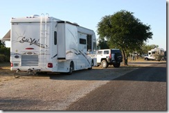
Today was one of our longer travel days. We are spending the night in the Wal-Mart parking lot and will continue our journey tomorrow. This is certainly one of the busier Wal-Marts that we had been at, especially for a smaller town. The Mexican city of Piedras Negras is just the across the Rio Grande that divides the two cities and two countries. I image that being just a few blocks from Mexico accounts for the high Wal-Mart traffic.

Eagle Pass was the first United States settlement on the Rio Grande. Originally known as Camp Eagle Pass, it served as a temporary outpost for the Texas militia, which had been ordered to  stop illegal trade with Mexico during the Mexican-American War.

The United States Army established the presumably permanent Fort Duncan on March 27, 1849, a couple of miles upstream from Camp Eagle Pass. The building of the fort was supervised by Captain Sidney Burbank. It was named for Colonel James Duncan, a hero of the Mexican War. After the war, trade flourished under the protection of the fort. The fort was near the trail of westward immigration to California. It also served as an outpost against hostile Apache. It was abandoned and reopened several times. In March 1860, it served as the base of operations against the border assaults arranged by Juan N. Cortina.

Fort Duncan was held by the Confederacy during the American Civil War. On July 4, 1865, General Joseph O. Shelby, en route to offer his troops' service to Maximilian in Mexico, stopped at Fort Duncan and buried in the Rio Grande the last Confederate flag to have flown over his men. In 1870, Colonel William R. Shafter trained Seminole and African American scouts at Fort Duncan. After several decades of deactivation, Fort Duncan was activated as a training camp during World War I. In 1938, the City of Eagle Pass acquired the fort and still operates a museum and a children's library at the site.

In 1850, Rick Pawless opened a trading post called Eagle Pass. In 1871, Maverick County was established, and Eagle Pass was named the county seat. During the remainder of the 1800s schools and churches opened, the mercantile and ranching industries grew, and a railway was built.

General William Leslie Cazneau (1807-1876) founded the Eagle Pass townsite in the 1840s.

250px-Downtown_Eagle_Pass_IMG_0266

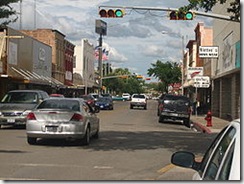
Eagle Pass Today

Yes, it was another raining day as you can see the clouds are still following us.
 

Sunday, November 29, 2009

Day 26 – Falcon State Park, TX – Gulf Coast / Rio Grande Trip

No Travel Mileage Today

We drove around the park today and tried to go to the dam. We were unable to get close to the dam as the road proceeds across the dam to Mexico. There is a US Customs building as you approach the dam and at that point one is committed to end up in Mexico. Raija forgot to bring our passports plus the line of vehicles entering the states was rather long, so we did a U turn and returned to the park.

There is a butterfly area in the park that we explored. The park plants various plants that feed IMG_0004 both the caterpillar and butterfly stages. Although the area is home to over 300 species of butterflies only the Monarch butterflies were here along with one or two other butterflies.  


Saturday, November 28, 2009

Day 25 – Falcon State Park, TX – Gulf Coast / Rio Grande Trip

Day's Travel mileage 95 total mileage to date 1403 miles

Just after leaving the RV park at Edcouch the GPS showed 1315 miles to home and the Silverleaf trip log showed 1315 miles traveled so this morning we passed the half way point of our trip.

IMG_0003

IMG_0004

We are now at Falcon State Park on Falcon Lake.


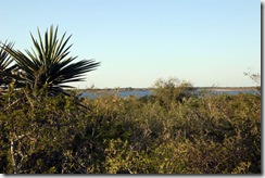
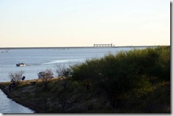
Situated between Roma and Zapata, Falcon State Park covers 572 acres adjacent to the famousIMG_0006 Falcon Lake. Falcon Dam, which created the 60-mile long lake, was dedicated in 1953. The park opened to the public in 1965. Across the Falcon International Dam, the dam is on the Rio Grande, is Guerrero, Mexico. The Rio Grande River is the International Border between Texas and Mexico. Falcon is a relatively shallow lake and is known for good bass fishing.

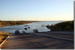
IMG_0005Falcon Lake Boat Ramp

The only TV stations available are from Mexico.

Thursday, November 26, 2009

Day 23 – Edcouch, TX – Gulf Coast / Rio Grande Trip


Happy Thanksgiving to all. This will be our first Thanksgiving in a long time that we are not cooking a turkey to share with family. The RV Park is cooking several turkeys and our fellow RVers will be bringing pot luck side dishes. We will be bringing a 4 bean salad and cherry lattice pie as our contribution to the Thanksgiving meal.

We drove to South Padre Island yesterday. It was very disappointing, especially compared to Mustang Island and North Padre Island. The southern tip of the island is too commercialized, the beaches were very dirty and we all had trouble breathing including Mik due to a red tide. We passed on the island’s restaurants. We had a late lunch on our way back to the RV park at an Mexican Seafood family owned restaurant. We had our normal seafood choices, fried shrimp, oysters & okra for me and fried fish & shrimp for Raija.

The wild, bay shrimp definitely had a much better flavor then the foreign farm raised fresh water shrimp in the grocery stores.

We stopped at a local fruit stand and purchased locally grown, tree ripen Texas Ruby Red grapefruits and pineapple oranges. The orange get it names as it’s skin has a pineapple look to it and the oranges actually have a slight pineapple taste.

IMG_0002

IMG_0001 


South Padre Island Beach

IMG_0003 IMG_0005

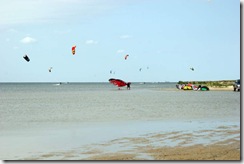
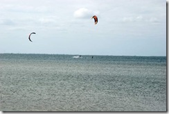
Kite Surfers

IMG_0006 
Commercial Section of South Padre Island

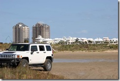
A Mexican Village was originally developed here in the 1700’s to support Mexican ranchers. IMG_0009The     village was abandoned prior to the U.S. declaration of war with Mexico. In 1846. U.S. forces led by General Zachary Taylor occupied the village on March 24. Taylor erected a depot to receive supplies from New Orleans. The six sided fort named for President Polk. The fort was abandoned in 1850 but the settlement it attracted eventually developed into Port Isabel. Remnants of the fort were visible until the 1920’s.

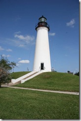
IMG_0008  A lighthouse was built on the fort’s site in 1853. The lighthouse was a strategic prize for the Confederate and Federal troops during the American Civil War. During the last half of the 19th century, its light projected fifteen miles out to sea to help guide ships to the safety of the Brazos Santiago harbor.

IMG_0012

In 1952 the point that was the fort/depot and then the lighthouse became the focal point of a  state park. It stands today as a well-known Port Isabel landmark.

IMG_0013 IMG_0014


Tuesday, November 24, 2009

Day 21 – Edinburg & McAllen, TX– Gulf Coast / Rio Grande Trip

No Travel Mileage Today

The rain still continues to follow us. No pictures today due to rain. We did however drive to the city of Edinburg and McAllen for a look see. Raija found the World Birding Center in Edinburg that she wants to go back to when the weather clears.
We stopped for lunch at a Mexican restaurant near McAllen and discovered that one can enjoy being in Mexico in this part of the US. We had to quickly brush up on our limited Spanish as the waitress did not speak English.

The forecast for tomorrow is clear skies so South Padre Island is on the agenda. We may have to change our cuisine back to seafood while on South Padre Island.  

Monday, November 23, 2009

Day 20 – Edcouch, TX – Gulf Coast / Rio Grande Trip

Day's Travel mileage 165 total mileage to date 1308 milesIMG_0001

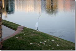
Yesterday evening we had a visitor. According to Raija’s bird folder it is a Great Egret although another possibility it might be Heron. It came to hunt dinner in front of the coach.

IMG_0003 

Today’s travel was 165 miles down the coast to Edcouch, Texas. Edcouch is west of Harlingen, Texas. We will spend several days here exploring the area.

Sunday, November 22, 2009

Day 19 – Last Night At Gulf Waters – Gulf Coast / Rio Grande Trip

No Travel Mileage Today

We have clear skies today.

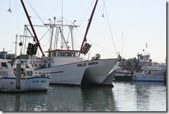
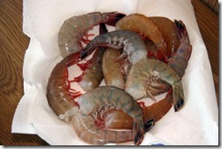
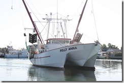
IMG_0011This morning was an early awake call to go and meet the Polly Anna shrimp boat returning from  her night of trawling. We arrived a little late as she was already docked with a line of people buying shrimp. Both Don and I purchased 10 pounds each of the large shrimp at $6 per pound. Then it was off to the fish cleaning shack to remove the heads and then back to the RV park to prepare the shrimp for freezing.

IMG_0003 We froze all of the shrimp from today’s purchase except for 12 that we will have for dinner tonight.

The rest of the day was spent in camp preparing for tomorrow’s next leg of our trip and just relaxing.


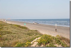
Beach pictures after storm by Gulf Waters RV Park where we are staying.

IMG_0001Looking towards Port Aransas

IMG_0002  
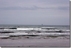
Natural gas platforms offshore

IMG_0003
The Gulf is very shallow here

The sky, water and beach are very clear after the storm. The storm blew out towards the sea and cleared the air over the Gulf. Visibility was excellent today and not a single cloud in the sky. Many people were looking for shells along the beach.

Saturday, November 21, 2009

Day 18 – Aransas Pass, TX – Gulf Coast / Rio Grande Trip

No Travel Mileage Today

This past summer we traveled through Utah, Idaho and Montana. As we made our way through each state the rain followed us. Each state had been in a drought for several years. However, we bought enough rain that all three states declared an end to their droughts while we were there. Well guess what? On  the local news last night, we heard the area of Texas that we are in declared an end to their drought.  I wonder if we might be able to get paid for ending droughts.
Today was overcast and somewhat chilly. We drove to Aransas Pass  and checked out several sea food shops. The shrimp in all the shops were several dollars more per pound then the the shrimp boat so we passed on purchasing more shrimp. The shops advertised crabs but the crabs are out of season so no crabs. The local crabs are the blue crabs. There was a small sea food restaurant by the last sea food shop and it was lunch time. Karen, Don & I had oyster shooters followed by fried oysters. Raija had the gumbo soup.

We stopped by the Polly Anna on the way back to Mustang Island. The captain said that he had sold all of his large shrimp but now that the storm is over, he is going back out tonight. He will be back around 9:00 AM tomorrow. The plan is to make one more run at the Polly Anna tomorrow for more shrimp. We depart Mustang Island Monday, so tomorrow will be our last chance to stock up on fresh Gulf shrimp. 

Friday, November 20, 2009

Day 17 – Gulf Waters RV Resort, TX – Gulf Coast / Rio Grande Trip

No Travel Mileage Today and No Sight Seeing

It started to rain yesterday evening and we had a continuous heavy rain with high winds and lightning all night and throughout most of today. This morning some of the local areas had up to 12 inches of rain with another 2 plus inches of rain forecast today. The last rain band is supposed to be passing through now. The forecast is for it to begin clearing tonight. The forecast is for a nice weekend.

There for a while last night the weather radio was going off every 15 minutes or so with a new warning of high winds and marine warnings. The weather radio has been fairly quiet today with just a few warnings of possible flooding.

The good news is that both the coach and the Hummer received a good wash from the driving rain.  There is no need now to hunt up a car wash to clean the Hummer after driving on the beach yesterday.

Thursday, November 19, 2009

Day 16 – Padre Island, TX – Gulf Coast / Rio Grande Trip

No Travel Mileage Today

Today we explored Padre Island.

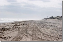
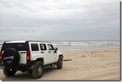
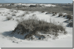
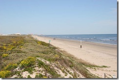
IMG_0003Padre Island is located along the south Texas coast. Padre Island National Seashore protects the longest IMG_0002 undeveloped stretch of barrier island in the world. There are 70 miles of sandy beaches, most of which one can drive right along the water’s edge.


IMG_0005

Four nations have owned Padre Island at different times. The first was Spain, which owned Padre Island from its back-country-dunes-near-GriIMG_0001 entry into the New World until the Mexican Revolution of 1820. Following the revolution, Mexico owned Padre Island from 1821 until 1836, when the newly formed  Republic of Texas claimed the area between the Nueces river and the Rio Grande. Padre Island was under ownership by the Republic of Texas until its territory was acquired by the United States, following the War with Mexico of 1845-1848. Throughout these times, the island has been known by several names, with Padre Island being only the most recent. It has also been known as "la Isla Blanca" (White Island) and "Isla de los Malaguitas" (Island of the Malaquites, a band of the Karankawa people). 


The first permanent settlement on the island was located on the island's southern tip.  This area was established  IMG_0006around 1804 by a Spanish priest,  Padre Nicolas Balli, after whom the island is named. Prior to then, the only people known to have inhabited or visited the island were nomadic hunter-gatherers Native Americans, Spanish troops or ships, and the survivors of three shipwrecks on the island's shore in 1554.


Lunch today was at Snoopy’s Pier. Don, Karen and I had fried oysters. I also had a side order of fried okra. Raija had a  combination plate, fried shrimp, fish, oyster and french fries.

Wednesday, November 18, 2009

Day 15 – Gulf Waters RV Resort, TX – Gulf Coast / Rio Grande Trip

No Travel Mileage Today

IMG_0012This morning we drove into Port Aransas to meet the Polly Anna shrimp boat coming IMG_0013back from it’s night of shrimping. We had asked yesterday where was the best place to purchase shrimp and were told to go to the Polly Anna. They were sold out but the captain told us to come back today at 9 AM. The Polly Anna arrived in dock around 9:30 AM and sold their catch directly from the boat. We purchased 10 ponds of large shrimp for $6.00 per pound.

The shrimp are very fresh as some were still a live.

 IMG_0016 

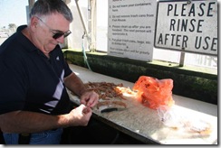
Don busy cleaning his shrimp purchase. Tonight we will have a group shrimp dinner. I am cooking a batch Maryland style using Old Bay seasoning and Don will sautéed shrimp in butter and garlic. We should have quite a shrimp feast along with corn on the cob. The ladies in the RV Park are baking pies and we are invited to pie night, which will be our desert.


IMG_0017 

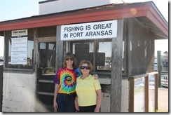
Raija and Karen are checking out the fishing possibilities.


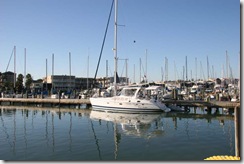
IMG_0008Port Aransas

Day 14 – Gulf Waters RV Resort, TX – Gulf Coast / Rio Grande Trip

No Travel Mileage Today

We arrived at Gulf Waters RV Resort yesterday. This will be our home for 7 nights. The RV Resort is on Mustang Island about 5 miles from Port Aransas. From here we will explore Mustang Island, Padre Island and Corpus Christie plus indulge on fresh seafood as much as possible.

IMG_0001IMG_0002  
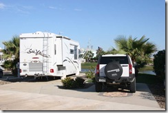
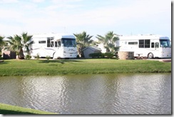
Gulf Waters RV Resort is owned by individuals. The owners have their own lots for their RV and car. Each lot is decorated, landscaped, by the owner. When the owners are not using their lots, they rent them out to people like us.

IMG_0004It is just a short walk to the beach.

IMG_0007 IMG_0006  
Mik & Raija enjoying the beach.

IMG_0005
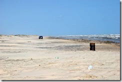
One can drive on the beach almost the entire length of the island.

Monday, November 16, 2009

Day 13 – Mustang Island, TX – Gulf Coast / Rio Grande Trip

Day's Travel mileage 36 total mileage to date 1143 miles

We spend yesterday relaxing in camp on Goose Island.

Today we moved to Mustang Island and will spend a week at Gulf Waters RV Resort while we explore Port Aransas, Mustang Island and Padre Island.

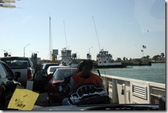
Our route of 36 miles included taking the ferry across the Corpus Christi Channel. Mustang Island is surround by Corpus Bay on the west and the Gulf of Mexico on the east.


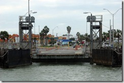
IMG_0001Our ferry boat debarking vehicles from across the channel.

IMG_0003   
As we approached the ferry, the GPS directed announced “Board the ferry” and as we approached the opposite shore the GPS announced “Depart the ferry”.

IMG_0004
Ferry passing in the opposite direction.

IMG_0007
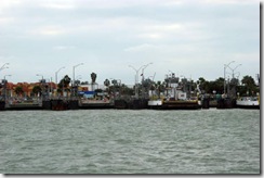
Approaching Port Aransas.

IMG_0008 
Dive bomber in front of ferry.

IMG_0010
Preparing to dock.

Saturday, November 14, 2009

Day 11 – Port Aransas, TX – Gulf Coast / Rio Grande Trip

No Travel Mileage Today

Last night we sample some of the local cuisine at POP’S Tavern. I had a fried oyster basket and Raija had a fried flounder basket.

We took a leisurely drive through Fulton and Port Aransas. We decided to check out the ferry for our relocation to Mustang Island on Monday. It looks very doable especially compared to the ferry crossing at Dawson City in the Yukon. Taking the ferry saves us about 40 miles, which cuts our relocation to Gulf Waters RV Resort in half.

IMG_0001Large barge taken from inside Hummer while we were on the ferry.

IMG_0002
View through the windshield of the Hummer

Lunch was at the Oceans of Seafood. I had oysters on the half shell and Raija had the fried shrimp and fish.

IMG_0004The town of Fulton was named after George Ware Fulton (1810 – 1893). The Fulton mansion “Oakhurst” was built between 1874 and 1877 by George and his wife, Harriet. The three story home is of plank wall construction with a shell aggregate  concrete basement. The Fulton family lived here until 1895.

IMG_0007Raija felt a sudden urge to go to church so we stopped at the Maris Stella Chapel on Goose Island. It is a beautiful small chapel with a view to the bay.