Sun Meadow’s Latest Lawn Mowers
Each Sunday there is a potluck dinner here at the resort. If one brings something, the potluck dinner is free, if one is unable to bring anything then the dinner is $6.00 so one does not have to feel guilty.
This Sunday I made Hot Wings. My special homemade rub was applied Saturday night and the wings sat in the refrigerator overnight.
 Wings after sitting in refrigerator overnight
On Sunday, I smoked the wings with apple pellets for two hours at 180 degrees and then cooked them in the smoker at 350 degrees for forty minutes.

Cooked Wings
After the wings were cooked, I placed them in a crockpot set on warm and added the hot sauce. The wings are served directly from the crockpot.
Rub recipe:
2 tablespoons smoked paprika
1 tablespoon plus I teaspoon sea salt
2 teaspoons sugar
2 teaspoons vinegar powder
1 & 1/2 teaspoons chili powder
1 teaspoon ground cumin
1 teaspoon ground black pepper
1 teaspoon tomato powder
1 teaspoon hickory smoke powder
1 teaspoon garlic powder
1 teaspoon onion powder
1/2 teaspoon ground cinnamon
1/2 teaspoon celery seeds
1/2 teaspoon cayenne pepper
Place four pounds of wings in a gallon Zip lock bag. Distribute about one half of the rub throughout the wings in the bag. Seal the bag and rotate the bag until the wings are evenly coated. Place the bag of wings in the refrigerator overnight and the next day until smoking / cooking time. Rotate the bag before retiring for the night and several times the next day.
Left over rub can be stored in a jar with a tight lid.
Hot Sauce recipe:
4 tablespoons butter (1/2 a stick)
1/2 cup Louisiana-style hot sauce. Hotness selected by your degree of hot.
1/4 cup of honey
1 to 2 tablespoons of Kirkland mince garlic in olive oil or similar brand / several garlic cloves
Heat the above in a sauce pan and bring to a slow boil.
Place the smoked / cooked wings in a crockpot and pour the sauce over the wings.
Set the crockpot on warm for at least 1/2 hour. The wings can be left in the crockpot on warm for up to an hour.
The folks here at the resort, were staying that Koko looked more like a bear club then a poodle. Both his and Strider’s coats were getting to be quite long and both were overdue for a grooming.
Koko did not get his first rabbi’s shot until two days before we left for the summer and since most groomers will not take a dog without a rabbi’s certificate, we had to put off his first grooming until after we got here.
Thursday we headed to St. Maries where he had Strider groomed last year. We were prepared for Strider to throw up as he does not take to traveling curvy roads very well whereas Koko has never thrown up when traveling. Well to our surprise Koko threw up first. I guess that the road to St. Maries is a little too much for either dog.
Anyway we made it there a little clean up and both pups got their summer haircuts.
Koko now looks like a poodle instead of a bear club
Strider’s summer hair cut
As you may remember from last year, St. Maries is a little short on barber shops, there is only one groomer but they do have two grocery stores and over the Fourth of July St. Maries boasts having the World’s largest topless bar.
At any rate while the pups were being groomed, we had lunch at Zips (a hamburger joint) and did our grocery shopping.

The last several days here, since Friday have been on the chilly side. It has rained steady since yesterday and has not gotten above 50. Up until now the weather has been great, mid-forties at night and high to mid-seventies in the afternoons. The forecast for Friday is sunny and the mid-seventies so hopefully Koko and I will be able to do the bike ride to Harrison for huckleberry ice cream.
For our anniversary Raija baked a huckleberry pie so all has not been lost on the huckleberry front.
Strider and Koko will be groomed this Thursday at the one and only groomer in St. Maries, ID. It will be Koko’s first grooming. It appears that Koko is finally house trained. It has been over a week now with no inside accidents. He has learned to go to the coach door when he needs to do his business.
Look for pictures of Strider and Koko after Thursday, once they are groomed.
I have my weather link up. You can view it at http://www.weatherlink.com/user/jimsalfaseeya. You may have to try several times as it will only be there if my computer is on. You can select "MAP" and then "Satellite". By zooming in you will see the coach and H3 at my RV site.
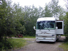
We arrived around 10:00 AM on Wednesday, May 21st. We were pretty much settled in and setup in time for the Memorial Day Weekend. The resort had a very good turnout for the holiday weekend, tent campers, RVers like us, hotel guests and local day visitors. Monday mid-day most of the guest had left and by Wednesday we and one other RVer were the only ones left. School is still in cession and the weather is still a little iffy here in the north.
The holiday weekend was filled with clear skies, day temperatures in the mid-seventies and nights in the low forties. The clouds rolled in on Tuesday bringing rain showers and chilly day temperatures. Wednesday did not even get into fifties.
The clouds are breaking up today and the sun is starting to warm up the day. It is now 57. Just in time for unveiling to mark the anniversary of Chas’ passing, and to remember the other people that the resort has lost since the 4C’s took over. There will be a short ceremony at the new gazebo at 4 PM. Some of us will have a few things to say. Then the owners will unveil the “thing” they have been working on.
Between then and dinner, anybody who wants to enjoy a pot luck wine and cheese party to celebrate the good time we DID have with those dear ones will be welcome to do so followed by a free dinner for everybody at 6:30 PM.
Well it took me a little longer than expected to process the videos that I took on our way here. I tried to high light a couple of spots along the way that I did not cover before plus our arrival at the Garden of Eden in Paradise.
I will have to do a better job at keeping the windshield clean as we drive along.

There was only 111 miles left to go to our destination and it was 11:30 AM when we arrived at the 50,000 Silver Dollar rest stop. The question was, should we have lunch, proceed on and arrive a day early or stay here in the free RV Park with 30 amp electricity, have lunch in the restaurant, have a relaxing afternoon and arrive early morning on our scheduled arrival day. It was quickly decided to do the latter as that would give us most of the day to settled in plus mow the grass if needed before pulling into our site. It was a good call as the grass needed mowing at our site.

10: 00 AM, Wednesday May 21st Destination Arrival

The forecast for tomorrow is sunny and the mid-seventies. So the plan is for a bike ride on the Coeur D’Alene Trail for the huckleberry ice cream at the Creamery in Harrison, Idaho. Koko has been in training and is ready to go for his share of ice cream. Strider will remain in camp as he does not take to bike riding.
We are all off for the summer to Paradise and the Garden of Eden. Our route is one that we have traveled many times before so I will not be covering the route in detail this time as it has been documented many times before.
We did alter our overnight stays somewhat. Our first night out was at Munds RV Park, 234 miles. The second night was at our usual stop at Utah 20 and US 89, 308 miles, where the night time temperature dropped to 31. The next day we traveled 316 miles to Hot Springs Resort in Garland Utah. We spent two nights at Hot Springs in order to have a non-travel day. The resort was just opening up for the season so the pool and hot tubs were not open. It was a little on the cool side anyway so we did not mind missing out on pool and hot tubs.
Yesterday we traveled a bit more than usual, 364 miles, to Deer Lodge, Montana where we woke up this morning to 28 degrees F.
Today we topped off the coach with diesel for the summer just short of Missoula, Montana and then the propane tank at Bretz in Missoula. Bretz still has 98 cent per gallon propane.
We are spending the night at 50,000 Silver Dollar just 111 miles sly of Paradise. This way we should arrive in the Garden of Eden before lunch giving us plenty of time to setup for the summer.
Once we are settled in, I will process and post some video that I took along the way.
Today I had my first huckleberry ice cone of 2014. One has to love Montana for its huckleberries.
We arrived home around 12:15PM today. Total miles put on the coach was 3035.
Temperature today in Tucson was 101 degrees F. A far cry from the seventies to low eighties during the day and the low forties that we had all summer in Paradise. I guess one might say that we left Paradise for Hell as far as the daily temperatures.
Strider seems to be adapting to traveling in the motor home. At least no more throwing up the past several days of traveling.
Now to unloading the coach, cleaning it and putting the house and yard back in order after being gone all summer.
The next trip is coming up soon, Big Sandy starting October 23rd, http://mgshooters.com/. This event will be a Reed male family event.
The coach maintenance was completed late Tuesday afternoon. We departed Camp Charlies Wednesday morning. Wednesday night was spent at an RV Park about mid-way between junction US89 and Utah 20 and Kanab Utah. This positioned us for a 293 mile drive today leaving 213 miles to travel to home tomorrow.
In the early morning hours of Feb. 20, 2013, a landslide ripped through a section of US 89 along a mountain slope about 25 miles south of Page, buckling more than 150 feet of the roadway and tearing the pavement up in six-foot-high sections.

The buckling of US 89 near Page, Arizona caught us by surprise on our journey north in early June. We had to detour over 45 miles on US89A. This added around two hours to our intended driving time on that day. 89A was very crudely, narrow with several mountains to climb and descend. We were not looking forward to doing that detour on the way back home.
Luckily for us Arizona quickly paved Navajo 20 from Page to the town of Gap where 89T (the T is for temporary) rejoins US 89. 89T parallels US89 so it adds only a few more miles to the original route. Actually 89T is much nicer than the section of 89 that it replaces as it much more level and straighter. The current speed limit is 40 to 45 near Page AZ and increases to 55 mph for most of the way.

Today was a short travel day, 144 miles from Fort Hall, Idaho to Camp Charlie’s in Sunset Utah.
Strider made it the whole way without throwing up. He is starting to enjoy sitting in Raija’s lap and looking out at the scenery. He naps most of the time until we hit a bump or a strange noise occurs.
Charlie’s is busy as usual. There are eight coaches here including us. Six are Alfas and there are two SOBs, Some Other Brand.
With a little bit of luck, we will be finished with our service tomorrow and we will depart Sunset Tuesday morning. I did plan for two days of service and a Wednesday morning departure just in case they are running behind schedule.

803 miles left to go
Well so far so good as it looks like the travel blog is working again after being locked out by some hacker.
We left Paradise yesterday morning around 9:00 AM. Our first stop was at a rest stop in Montana just after crossing the Idaho / Montana border. About two miles from the rest stop, Strider threw up. Well he almost made it to the rest stop. On the way from home to paradise, Strider threw up every morning. But maybe there is hope, today we traveled 276 miles from Deer Lodge Montana to Fort Hall Idaho without any upchucking from Strider.
Our first day’s mileage was 280. It seems a little odd to leave Idaho and enter into Montana, travel a day and a half in Montana and end up spending the night again in Idaho.

Raija and Strider in Coach – Fort Hall, Idaho
We will spend the tonight in the RV Parking Area at the Fort Hall Blackfoot Indian Casino. Full hookups, including 50 amps is $21.63. Tomorrow we travel 144 miles to Champ Charlie’s in Sunset, Utah for the coach’s annual service. As some of you will recall, Camp Charlie's is across from Hill Air Force Base where our son, Jimmy, was based some years ago. Jimmy was promoted to Colonel at Hill Air Force Base.
Someone hacked into my Google account and locked out the travel blog. Hopefully all is restored now.
Friday’s, September 14th, post.
Sadly it is time to depart Paradise, especially since there are only two bottles of beer left.
We had been busy packing up for the last four days. Amazing enough, we found a place for everything.
This morning we finished the last chores for departure and said goodbye to the owners, a few of the residents that were having breakfast in the lodge and fellow RVers.

Our departure would not be complete without a tour of Worley, Idaho. Worley is the closest town to Paradise. Now you see why we do most of our shopping in Coeur d’Alene at Fred Myers, Costco or Wal-Mart.

.
It took all week to get the video uploaded. The size of the file and the upload speed of the internet here required more than 48 hours to upload the video of the trail. During the week the power company was changing out the lines along the main road. At least once a day they would cut the power which in turned stopped the upload process and required another attempt to try a new upload. There was no power interruption on Friday, so Thursday’s upload restart finally completed late last night.
The first video, Chatcolet to Harrison via Coeur d'Alene Trail is rather long as it is just over seven miles from Chatcolet to Harrison.

The history of the trail was covered in an earlier blog.
As mentioned before Harrison is home to the Creamery so a short video of the Creamery is a must.

The batteries on the helmet video camera gave out on the return trip so scenes on the way back will have to wait for another attempt for huckleberry ice cream.
The local farmer markets are starting to carry fresh huckleberries. We purchased a quart for $10 the other week and Raija baked a huckleberry pie which provided me with my huckleberry fix until the next trip to Harrison.
It has been a while since I have posted on our travel blog so here is just a short note to let all know that all is well in paradise. We have been busy just relaxing and enjoying the happenings here, exercising in the indoor 92 degree pool and cooling down in the outdoor 84 degree pool.
Strider enjoys his walks with Raija several times a day.

Strider looking for Raija’s return from the pool.
This summer has been filled with many concerts here at the resort. This weekend we had two, one on Friday and another one this evening.
Friday’s Concert featured Jesse Terry

Jesse Terry is a nationally touring, award-winning singer-songwriter and road warrior.
His music has been compared to the likes of Jackson Browne,
Paul Simon and James Taylor.
Jesse has toured relentlessly in support of his two albums,
sharing the stage with such great singer/songwriters
as Mat Kearney, David Wilcox and Lori McKenna.
Jesse is a regular at some of the finest listening venues in the country,
including the famous Bluebird Café in Nashville.
Tonight we are being entertained by Scott Kirby
![clip_image001[5]](http://lh3.ggpht.com/-6X034I3jEvU/Ugb35RZz06I/AAAAAAAADDM/n7SaP1EUQ7c/s1600-h/clip_image001%25255B5%25255D%25255B3%25255D.jpg "clip_image001[5]")
Pianist/composer Scott Kirby specializes in
distinctly American musical styles which include
Classic Ragtime, New Ragtime, Creole Music and Terra Verde.
As a performer, he is also an educator,
providing historical context and musical insight into the program as it unfolds.
Each concert may include examples from North America,
South America and the Caribbean,
illuminating how a rich musical heritage
evolved from a mélange of ethnic music and "art music",
from the aural and the composed traditions.
Concerts may contain short pieces from Latin America
and the French Caribbean such as the Haitian meringue,
the beguine from Martinique, the Puerto Rican danza,
the cumbia or the Cuban habanera.
In addition, Kirby champions writers of New Ragtime and Terra Verde,
contemporary counterparts to the more traditional styles.
As a composer, Kirby combines the influence
of nineteenth century romanticism
with these New World idioms into his own
individual, syncopated language.
This past Wednesday we rode the bikes on the Coeur d’Alene trail to Harrison and enjoyed the Creamery’s ice cream. I am working on the video footage from a helmet mounted HD camera and hope to be able to post it in the next day or two.
Probably the best way to catch up on the happenings during past week is to incorporate the Musings newsletter put out by the resort authored by Margie Cantlon, one of the owners and wife of Chas.
Thursday, July 11, 2013
This is the day that is dedicated to celebrating Chas’ life.
We’ll begin that in earnest at the 4:30 patio party,
but just remember, having fun all day is a requirement!
7 AM Beginner Yoga

7:30 AM Aquacise in the warm indoor pool. 
8-9:30 AM our hot breakfast ($6.50 tax included)
Eggs to order with bacon, morning glory muffins, toast, juice & coffee.
Continental breakfast ($4.50 tax included) FREE with a room
9:30 AM Nature Walk
Find out about the flora on our hiking trails with Margaret.
She’s getting up early to take the walk before it gets too hot!
10 AM Frisbee Golf

11:30 Volleyball 
11:30 AM John Mosley will discuss sunspots

Because this year is the peak of the 11-year solar cycle
there are sunspots visible every day.
(Some of them cause displays of the Northern Lights
and if we're lucky we'll see them too one clear night.)
Our resident astronomer, John Mosley will show sunspots
and do a little interpretation on the sun.
It'll be visible from the pool area -- and showing the sun for an hour;
people can wander over on their own for a peek.
If the day is overcast, we’ll reschedule for another day during the Festival.
11:30-1:30 PM Lunch
Snack Bar on the Patio
A vast array of choices for lunch!

Geoff has volunteered to help us out with
Tunes by the pool Thursday afternoon! 
2 PM Shuffleboard 
2 PM Jay and Lee will lead a quick dance lesson
to prepare for the DJ dance.
Meet in the lodge on the dance floor.
4:30 PM Pot Luck Patio Party
Bring what you like to drink and
A snack to share.

We will be providing beer and wine for this party.
We will also have a microphone set up
And anybody who would like to share
A story about Chas is welcome to do so.
And after dinner, at 9 PM, the celebration will wind up with a DJ dance.
John, of recent tunes by the pool fame, has volunteered
To DJ this dance to leave Margie free to visit.

--Friday, July 12, 2013
Morning coffee is on at 7 AM
7 AM Beginner Yoga
![clip_image001[1]](http://lh6.ggpht.com/-jIa_XZ_OUbw/UeWHJ7fRb4I/AAAAAAAAC70/L4oyWBzQWZ8/s1600-h/clip_image001%25255B1%25255D%25255B2%25255D.jpg "clip_image001[1]")
7:30 AM Aquacise in the warm indoor pool.
![clip_image002[1]](http://lh3.ggpht.com/-BPqIMMhKFzc/UeWHKyy2O1I/AAAAAAAAC8E/0eHOnUX0fZY/s1600-h/clip_image002%25255B1%25255D%25255B2%25255D.jpg "clip_image002[1]")
10:00 AM Pickleball

11:30 AM Volleyball
![clip_image004[1]](http://lh5.ggpht.com/-_vkPMtpw1UA/UeWHMYoeMBI/AAAAAAAAC8k/lyHNr_gKQlk/s1600-h/clip_image004%25255B1%25255D%25255B2%25255D.jpg "clip_image004[1]")
11:30-1:30 PM Lunch
Snack Bar on the Patio
A vast array of choices for lunch! 
1:30 PM Workshop
Do you have an iPhone?
Is it as much a mystery to you as it is to me? 
Look at all those apps! How do they work?
Brian Sommerfeldt, a certified young person,
Has gallantly offered to share his expertise
On the iPhone with us geezers!
John and Laurie will be joining Geoff for
Tunes by the pool Friday afternoon! ![clip_image007[1]](http://lh6.ggpht.com/-yBlmLajN2Js/UeWHPETwV3I/AAAAAAAAC9U/3wXCnISmTaI/s1600-h/clip_image007%25255B1%25255D%25255B2%25255D.jpg "clip_image007[1]")
2:00 PM Bocce

4:00 PM Ping Pong on the Patio 
4:30 PM a second patio party!
Bring whatever you like to drink
And something to share
And bring your friendship and conversation! 
6:30 PM Soup, Salad & Homemade Bread ($7 tax included)
Taco soup, homemade bread, salad & cookies
8 PM Concert on the Stage
Tickets $12
James Lee Stanley returns to Sun Meadow

![clip_image001[2]](http://lh5.ggpht.com/-uBzkTYZYEgs/UeWHT8vwBQI/AAAAAAAAC-k/zLA3y7cnyuI/s1600-h/clip_image001%25255B2%25255D%25255B2%25255D.jpg "clip_image001[2]")
7:30 AM Aquacise in the warm indoor pool. ![clip_image002[2]](http://lh5.ggpht.com/-NTXggKmjNqw/UeWHUn8N9JI/AAAAAAAAC-0/o1T8rf2amBI/s1600-h/clip_image002%25255B2%25255D%25255B2%25255D.jpg "clip_image002[2]")
8-9:30 AM our hot breakfast ($6.50 tax included)
Morning glory muffins, eggs to order, bacon, toast, juice & coffee.
Continental breakfast ($4.50 tax included) FREE with a room 
9:00 AM Frisbee Golf ![clip_image003[1]](http://lh4.ggpht.com/-NdGYLrloggo/UeWHWjOgNFI/AAAAAAAAC_U/31zciM594Sc/s1600-h/clip_image003%25255B1%25255D%25255B2%25255D.jpg "clip_image003[1]")
10:00 AM Pickleball ![clip_image011[1]](http://lh3.ggpht.com/-Jabaan0Szmk/UeWHXTKUlQI/AAAAAAAAC_k/CBaUKaJrDPk/s1600-h/clip_image011%25255B1%25255D%25255B2%25255D.jpg "clip_image011[1]")
11:00 AM Learn to Make a Bracelet
Meet at Val’s tent on the patio to make your own bracelet.
Cost is $5 to cover materials. 
11:30 AM Volleyball ![clip_image004[2]](http://lh4.ggpht.com/-c4Rz4AvoQBM/UeWHZPGqHtI/AAAAAAAADAE/RT9H2T97IqQ/s1600-h/clip_image004%25255B2%25255D%25255B2%25255D.jpg "clip_image004[2]")
11:30-1:30 PM Lunch
Snack Bar on the Patio
A vast array of choices for lunch! 
John and Laurie will be back with Goeff this weekend!
Tunes by the pool Saturday afternoon ![clip_image007[2]](http://lh5.ggpht.com/-Zc9Kq5eCd9w/UeWHbD-vyUI/AAAAAAAADAk/tQKmB7fii6A/s1600-h/clip_image007%25255B2%25255D%25255B2%25255D.jpg "clip_image007[2]")
2:00 PM Bocce 
4 PM Ping Pong on the Patio
4:30 PM Another Potluck Patio Party
Bring some finger food to share
and whatever you like to drink.

6:30 PM Dinner $11 (tax included)
Marinated pork tenderloin, rice, steamed broccoli,
salad, sourdough, dessert
8 PM Concert Featuring Otter Creek
Tickets $12

-- Sunday, July 14, 2013 –
7 AM Beginner Yoga
![clip_image001[3]](http://lh6.ggpht.com/-a51MxBLkc_o/UeWHe7VpWVI/AAAAAAAADBk/S5ZhTqbqCwM/s1600-h/clip_image001%25255B3%25255D%25255B2%25255D.jpg "clip_image001[3]")
7:30 AM Circuit Training with Terri on the Mezzanine
Morning coffee is on at 7 AM
8:30-9:30 AM our hot breakfast ($6.50 tax included)
Waffles, scrambled eggs, sausage, toast, juice & coffee
Continental breakfast ($4.50 tax included) FREE with a room
11:30 AM
Community Garden meeting

Brian and Tracy want to work with any folks interested in
planting and caring for a community garden out by the tennis-court-to-be.
Meet in the dining room at 11:30 and the will take it from there.
11:30-1:30 PM Lunch
Snack Bar on the Patio
A vast array of choices for lunch! 
3 PM FREE Concert on the Pool Deck
Strangled Darlings 
This will be a fun one!
Led by multi-instrumentalists George Veech and Jessica Anderly,
Strangled Darlings are a quickly becoming
one of the brightest lights in the galaxy of musicians
that populate their hometown of Portland, Oregon.
The group's tunes are a spirituous and devilish attempt
to bring the folk/country/jazz world back to its roots
as a bawdy, political, and tuneful mix of low and high art.
6:30 PM Our $6/Free Famous Potluck
Bring something and it’s free
or bring $6 and it’s guilt free
Keeping the pools and hot tub clean plus running the outdoor lunch and all of the other activities kept us quite busy throughout the festival.
Yesterday I spent the day fine tuning on the Wi-Fi system throughout the RV and tenting areas.
Today will be catching up on chores in the coach and at our site. Thunderstorms are forecasted for tonight.
Weather permitting, a bike ride to Harrison for Huckleberry ice cream is on the agenda for tomorrow.
Chas, one of the owners and who recently passed away, coined the term “Skin to the Wind. The festival has been an annual and popular event. Chas requested that a party be held instead of a funeral when he died. So this year’s Festival is honoring his request and his life.
Wednesday’s start was a little slow but RVs streamed in the late afternoon as well guests for the hotel rooms. This year’s festival’s attendance surpassed the previous years as many are making a special effort to celebrate Chas’s life.
The Festival kicked-off on Wednesday with a concert featuring TR Ritchie who was a close friend of Chas.
TR Ritchie goes from a busking at Pike Street Market to kicking it at Kerrville, Napa and Walnut Valley, this unreconstructed folkie sounds like the folk music we'd have been listening to all along. Ritchie writes plays and sings with heart and conviction and an innocence that you wouldn't expect from someone that's been around a few rough and competitive blocks. A dreamer with at least seven toes on the ground, Ritchie is a very solid link on a very solid folkie chain that somehow manages to command your attention without demanding it.

TR Ritchie
Both Raija and I have been kept busy helping out. The large crowd has meant extra effort to keep the pools and hot tub clean. Both of us start preparing for the patio lunch bar at 10:30. The lunch bar opens at 11:30 and closes at 1:30. Cleanup takes another 45 minutes or so. Strider keeps us company at the lunch bar. Two-K, (born in 2000) and Strider luck out in sharing hot dogs, turkey burgers and hamburgers that gets a little too well done on the grill.
Concerts and dancing occupy the evenings so we have been kept busy these past four days. Today is the last day of the festival so hopefully this week I will be able to catch up on the blog.
This morning we made the 18 mile trip from Heyburn boat launch state park to Harrison. The main objective at Harrison of course was the Huckleberry ice cream at the Creamery.

Preparing to depart the boat ramp parking area by the Coeur d’Alene Trail

Boat houses at the Heyburn Park
Along the way we encountered a pond with red flowers in bloom on the lily pads that are floating on the pond. Sorry for the burry image, I still have problems taking pictures with the IPod.

Lilly Pond

We arrived at Harrison only to discover that the Creamery was closed. They had run completely out of ice cream over the holiday weekend. Lesson learned, do not peddle your ass all the way to Harrison on a Monday, much less a Monday after a long weekend as most likely the Creamery will be closed.
Since it was now noon, we decided to have some lunch in place of ice cream. We chose the marina. It was not too bad of a substitute, Raija had a cheese quesadilla and I had a hot dog with onion rings.

Lunch at the marina

Harrison Marina