Today’s Mileage 102
Miles to Date 4826
Miles Remaining 4816
We originally planned to travel about half way to Tok today but we decided to make a side trip to Haines Alaska so we will be spending two nights here at Haines Junction.
Haines Junction is a village in the Yukon, Canada. It is located at Kilometer 1,632 (historical mile 1016) of the Alaska Highway at its junction with the Haines Highway, hence the name of the community.
For many thousands of years the Southern Tutchone people had seasonal hunting and fishing camps in the area of present-day Haines Junction. The original name of the area was "Dakwakada", a Southern Tutchone word meaning "high cache". It was common for Tutchone people to use raised log caches to store food year-round or temporarily while they hunted and fished in an area.
Haines Junction, Yukon
The Haines area was also important for trade between the coastal and interior peoples. Its proximity to the Chilkat Pass, one of only three passes that allowed travel between the coast and the interior, was used extensively for trade between the coastal Tlingit and Southern Tutchone people.
The current town of Haines Junction was established in 1942 and 1943 during the construction of the Alaska Highway. In 1943 a second highway, the Haines Highway, was built to connect the Alaska Highway with the coastal town of Haines, Alaska over the Chilkat Pass. Situated at the junction of these two highways, Haines Junction was a construction camp and a supply and service centre for the US Army Corps of Engineers building the highway.
Today we started catching glimpses of North America’s largest ice fields.


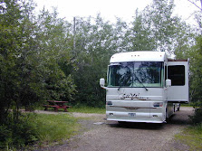
Campground View

No comments:
Post a Comment