Today’s Mileage 91
Miles to Date 5385
Miles Remaining 4266
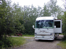
We drove back to the Richardson Highway from Kenny Lake, turn left and arrived in Valdez around 1:00 PM. We will be spending the next three nights at the Valdez Glacier Campground. The campground has 30 & 20 amp electrical but no water or sewer for $25 per night.
We started the day in clear skies but as we approached the coastal mountains with large glaciers we ran in fog, clouds and then rain. It is presently raining and the mountains are obscured in the clouds.
As I mentioned previously, the glacier mountains make their own weather, which was very obvious as we approached the Worthington Glacier that is very near the highway.

Worthington Glacier
You can see the fog being created by the Glacier.
The drive is very scenic as the road follows the Copper River for a while and then works its way along side several rivers whose source are the glaciers. Closer to Valdez the highway passes by Bridal Falls and then Horse Tail Falls.

Bridal Veil Falls

Horse Tail Falls

The Trans-Alaska Military Pack Train through Keystone Canyon that led to the first glacier-free land route from Valdez to the interior originates near Bridal Falls. The first gold rush trail led over the treacherous Valdez Glacier, then northeast to Eagle and the Yukon River route to the Klondike goldfields. Captain W. R. Abercrombie and the U.S. Army Copper River Expedition of 1899 rerouted the trail through Keystone Canyon and over Thompson Pass, thus avoiding the glacier. The military kept the trail open to connect Fort Liscum in Valdez with Fort Egbert in Eagle even after the gold rush ended. In 1903, the U. S. Army Signal Corps laid the trans-Alaska telegraph along this route.

No comments:
Post a Comment