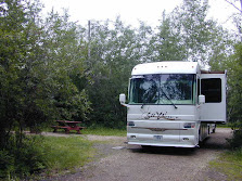
As I mentioned yesterday, we bypassed Dawson Creek, the famous Mile Post 0 of the Alaska Highway to save mileage. Both Don and I have been to Dawson Creek on our previous trip to Alaska. The first two nights are at the Ross H. Maclean Rotary RV Park. They are a little pricey at $40 per night for full hookups. But it does give us a chance to catch up on the laundry, empty our holding tanks and fill the fresh water tank with Reverse Osmoses water. We hope to relocate tomorrow to the Charlie Lake Provincial Park for $16 per night, dry camping. The problem is it is the weekend and the Provincial Parks seem to fill up with local campers. Our backup is the local Wal-Mart parking lot.
Tomorrow will be camp rest day if we get into the Provincial Park. Sunday we will take a loop drive along the Peace River and outlying communities. Tuesday we will continue our journey towards Alaska.
We are several days ahead of our original schedule plan so this layover we aid in getting us back on schedule. Why a schedule? It turns out that that at the present rate we will be on the Kenai Peninsula in the middle of fishing season. We could not get reservations at the campgrounds there until August 1st so we need to do most of our sightseeing on the way up to the Kenai Peninsula so as on August 1st.
The City of Fort St. John is a small city in northeastern British Columbia, Canada. A member municipality of the Peace River Regional District, the city covers an area of about 22 km² (8 mi²) with 17,402 residents (2006 census). Located at Mile 47, it is the second largest city along the Alaska Highway, after Whitehorse. Originally established in 1794, as a trading post, Fort St. John is the oldest European-established settlement in present-day British Columbia.
Over the years the community has been moved a number of times for varying economic reasons. The present location is thought to be its sixth. The original trading post built in the area was named Rocky Mountain House. It was established one year after Sir Alexander Mackenzie explored the area in 1793. One of a series of forts along the Peace River constructed to service the fur trade; it was located southwest of the present site of Fort St. John. The Dunneza and Sikanni First Nations used it as a trading post. It was also used as a supply depot for further expeditions into the territory. The fort closed in 1805. Fort d'Epinette was built in 1806 by the North West Company. It was renamed Fort St. John in 1821 following the purchase of the North West Company by the Hudson's Bay Company. This fort was located about 500 meters downstream from the mouth of the Beatton River. It was shut down in 1823.
Fort St. John was reopened in 1860 on the south side of the Peace River, directly south of the present 
Fort St. John is the transportation hub of the region. The main highway, Highway 97 (Alaska Highway), built in 1942 by the United States Army, runs through the city, north to Fort Nelson, the Yukon, and Alaska. As the highway goes over the Peace River to Dawson Creek, it reduced the community's dependence on the river for transportation.


No comments:
Post a Comment