Saturday, June 20, 2009

Day 31


Spring Gulch – Sula, MT

More overcast skies and rain. No sun, no solar charging so I have to run the generator to charge the batteries and run the heat pumps to warm the coach. It is only 54 degrees at 2:00 PM. The low last night was 48. Not much daytime warming.

This area has an interesting history, the pictures tell the story.

Click on the pictures to enlarge.

Sula 03The Meeting Place 08 Sula Montana  


Salish meet Lewis & Clark 04 Salish meet Lewis & Clark 05 Salish meet Lewis & Clark 06

 The Meeting Place 13

The Meeting Place  The Meeting Place 09

How it looks today 


 Salish meet Lewis & Clark 16 Salish meet Lewis & Clark 15Salish meet Lewis & Clark 17


Trout Fishers 10 Trout Fishers 11 Trout Fishers 12

Trout Fishing on the Bitterroot River

Bitterroot Mountains 14

The Bitterroot Mountains

Road History 01

Highway History

Friday, June 19, 2009

Day 30

Today we traveled a whole 80 plus miles to Spring Gulch, MT. Now one might ask, why drive so little? Well there are two reasons. One is when retired, why hurry. The second and more important is, Don needs time to find Montana Huckleberries and Karen needs time to bake the huckleberry pie before we arrive at their home on Monday.

Today’s drive took us up over the Bitterroot Mountains. It is easy to see why the Bitterroots cause such a difficult time for the Lewis & Clark exploration party and why they lost so many horses to falls and exhaustion. The forest is so thick that one cannot see what lies ahead and the mountains are very steep.

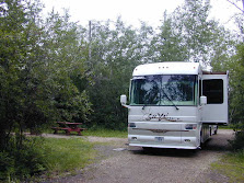
We are camped in the Bitterroot National Forest alongside the Bitterroot River. We plan to spend two nights here. There is cell phone and internet service plus one TV station, NBC.

Spring Gulch Campground 01Spring Gulch Campground

Bitterroot River 01 Bitterroot River 03 Bitterroot River 04

Bitterroot River

Day 29

Today was spent in camp relaxing and catching up on housekeeping chores as the next couple of days will be dry camping along side the Bitterroot River.

The country store near the campground received huckleberry ice cream today. Desert was huckleberry milk shakes. Mik enjoyed his cut of both Raija’s and my milk shakes.

Hopefully Karen will have homemade huckleberry pie with huckleberry ice cream on top when we arrive.

Wednesday, June 17, 2009

Day 28

We are camped at a small RV Park in North Fork, Idaho along the Salmon and the North Fork of the Salmon River. The North Fork Salmon River joins the main Salmon River here. Lewis and Clark explored both rivers in their quest for a water route to the west coast. Just north of here along the North Fork they encountered some Flathead Indians. The Flatheads spoke a language that none in the party recognized.

Salmon River 01

Salmon River 02


Salmon River


Old Mine Pump House on Salmon River 04Old Mine Pump House on the Salmon 


Elk Herd 06

Elk Herd 05


Elk Herd Across the Salmon River

Tuesday, June 16, 2009

Day 27

Wouldn’t you know it! Today the sun came out and it is our departure day. We continued north on 93 along the Salmon River to North Fork and an RV Park with full hookups so Raija can do the laundry. There is no cell phone service the RV Park does have WiFi.

We just missed by minutes having a car broadside us. I had the coach parked in the parking lot while I went in to pay for our site. I then moved the coach to the RV Sites and we chose a site. When I walked back up to the store to tell them my site number there was a car slammed into two cars right where we were parked. It appears that the driver had a stroke or heart attacked, ran off of the highway into the parking lot, broad sided a car parked in the same spot that we where we were parked. The force of the impact pushed the car that he hit into the side of another parked car.

I was able to get some better pictures of the mountains with snow now that the sky cleared.

Snow Capped Mountains

Click picture to enlarge

Monday, June 15, 2009

Day 26

We had partly cloudy skies today. It turned out to be a good day to tour Mackay’s Mine Hill, the town of Mackay (population 550) and the Mackay Dam.


Mackay from the mountain Mackay mushroomed into existence in 1901, when the railhead serving the mines was located on the eastern edge of the present city. During its heyday, Mackay boasted a population of several thousand.


Lost River 02 The Lost River Valley belonged to the American Indians for nearly 10,000 years, not as a permanent home, but one of many hunting and gathering sites.


Lost River 01 The area was visited by the first white man in June, 1823 by a French trapper, Antone Godin, who gave his name to the river. Ten years later, the river could not be found; hence, the “lost” river became the Big Lost River.


Mackay’s Mine Hill

Click on the pictures to enlarge them to read the history of the mining hill.

IMG_0005 IMG_0006 IMG_0007

IMG_0007A IMG_0008

IMG_0013IMG_0011  IMG_0012

IMG_0014

IMG_0016  IMG_0019 IMG_0020

IMG_0021

Sunday, June 14, 2009

Day 25

Today we woke to cloudy skies. By the time Mik was walked and breakfast was over, the rain started and lasted through noon. About 2:00 PM the rain stopped. The skies are stilled overcast but I was able to grill a rib eye steak for dinner. A break in the rain is forecast tomorrow.

The Mackay Reservoir is on the Big Lost River. The Big Lost River and the Little Lost River are so named as they disappeared into layers of porous basalt and subsurface gravels. The rivers flow underground about 130 miles to the southwest. The waters eventually surface at Thousand Springs on the Snake River in Hagerman Valley, southwest of Twin Falls, Idaho.

Homesteaders were drawn to the Big Lost Valley in the early 1900s by the promise of cheap land and speculation that a 125-foot dam would be built to irrigate thousands of acres near Arco. Although the water was badly needed, residents of Mackay feared that the dam might fail and fiercely protested its construction. A prominent engineer condemned the dam’s design in 1910, plans were scaled back and a 65-foot dam was constructed followed by a cannel system in the early 1920s.

Drought hit the area in the 1920s and early 30s. Water shortages were made worse by evaporative water loss from the reservoir and lengthy irrigation canals. By 1930 nobody was getting enough water, farms were abandoned and property values were reduced by half.

Angry Mackay farmers, desperate to irrigate their lands, dynamited the dam’s controls, releasing the entire reservoir back into the river. This supplied water locally to Mackay and stopped the irrigation through canals to farms near Arco. Resolution came in 1935 when local residents banded together and purchased the dam.
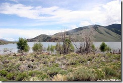
Mackay Reservoir 04 Mackay Reservoir06 New snow in the mountains & high water

The reservoir is at capacity

Saturday, June 13, 2009

Day 24


Today we traveled 144 road miles from Massacre Rocks State Park to Mackay Reservoir. As the crow flies it is only 95 miles. The Snake River and mountains sure do get in the way.

The weather was overcast the whole trip but no rain. About ¾ of the way we did our good deed for the day. At the junction of US 26 & US 20 there was a large gravel lot that we pulled into for a pit stop. We pulled alongside a red car with a young lady in it. She got out and looked at us as if she was waiting for someone. As we were about to leave, she again got out of her car and looked at us. I then asked if she was okay. It turned out she was a nurse that worked the nightshift at a Pocatello hospital and she was on her way home that is in Arco an 80 plus mile commute one-way. She was too sleepy to drive and had pulled off at the junction to sleep. When she woke, her battery was dead as she had left her lights on.  We were able to push her car alongside the Hummer and jumper the batteries to get it started.

Mackay Reservoir We arrived at Mackay Reservoir at 1:30, set up camp and had lunch. About 4:00 the downpour came. Yesterday on the local news they said that Idaho Reservoirs are now 86% to 101% full. Most are in the high 90% range with several at 100% and one at 101%. More rain is forecast through the week. Currently the outside temperature is 53. During the past week lows have been in the upper 40s and highs in the low 60’s.


The campground is on BLM land. The Golden Eagle discount with electric and water is $9.00 per night.


Lost River Range The snow covered peak is 12,662 feet. It most likely got more snow this afternoon.

Friday, June 12, 2009

Day 23


Ancient Water Falls01Ancient Water Falls – The water drain out of Lake Bonneville for 8 weeks


Pelican Rock 02 Pelican Rock 03

Pelican Rock down from our RV Site – My name for it since pelicans roost on it every day.

We finally woke to blue skies this morning. As this is our last day at Massacre Rocks, we decided to take a ride down river to Lake Walcott Reservoir. Raija wanted to see the dam and campground there. We both decided that the Massacre Rocks Campground is better.

Snake River Rapids There were some rapids in the Snake River just below the dam. They are probably similar to what the American Falls were before they built the dam at American Falls although I suspect that the American Falls was actually more of a falls then rapids.

We made it back to our camp at Massacre Rocks just before a thunder storm with hail hit. Now we are back to a steady rain. Hopefully with a little luck, it will be dry in the morning for out departure north.

Rapids below the dam at Lake Walcott

Thursday, June 11, 2009

Day 22

More rain! We woke to an overcast sky and rain showers. The forecast is for rain showers throughout the day with a break from the rain tomorrow. Idaho is several inches ahead on rain to date and the local TV stations have declare that Idaho’s drought is over.

With the rain, it was a good day to sleep in, relax in the RV and enjoy the view of the Snake River.

Wednesday, June 10, 2009

Day 21

Today’s forecast is showers throughout the day and this morning the forecast was right on so we decided to hang out at the RV, have lunch and then take a drive into American Falls. After all the name implies that there must be a falls there on the Snake River. Well there was a falls there back during the wagon train days. But with the coming of electricity someone decided that it would be a good place for a power generator plant. The first generator took advantage of the falls and the falls remained in place along with the town of American Falls.

In 1925 Idaho Power decided to build a dam for a larger power plant. Since Al Gore was not around, the dam was built and now there is no more falls. Even the town had to be moved as the original town site and old wagon bridge are now under water.


Modern Dam


Old Power House


Rocks that formed the Original American Falls